Top picks in No Man's Land
The places most worth your time here.

Connect your Cour circle to see which places friends and family recommend here.
Connect Cour →Landmarks
23 places worth the detour
Includes 2 ghost landmarks— places that existed here and don’t anymore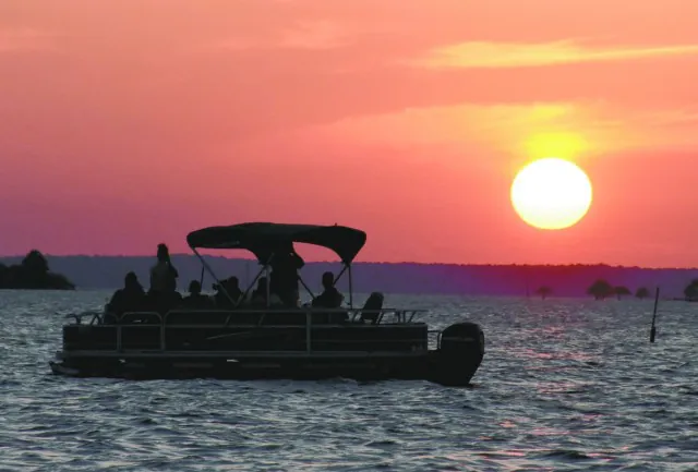
tap the eye to open · swipe or use buttons to browse
From 1806 to 1821, this strip of land between the Sabine River and the Arroyo Hondo had no government. The Louisiana Purchase of 1803 set off a boundary dispute between the United States and Spain,…
Read the full storyReading
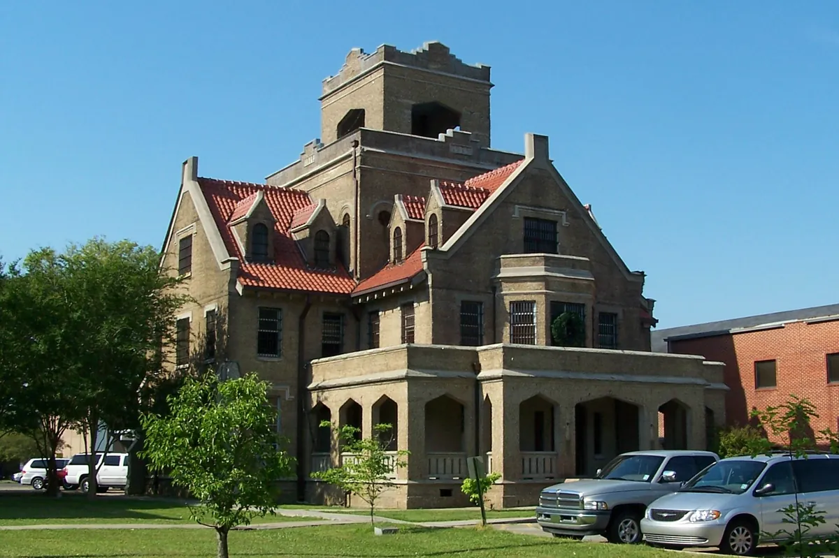
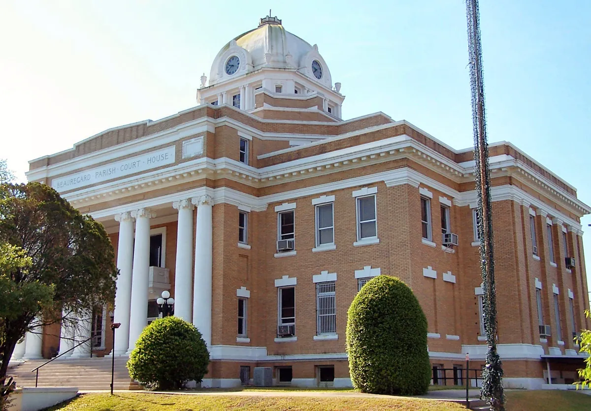
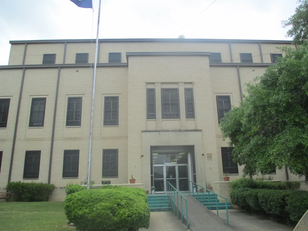
When the Adams-Onís Treaty ended the Neutral Strip's lawlessness in 1819, the United States had to build governance from nothing on ground that had belonged to no one. Colonel Zachary Taylor arrived in 1822 to establish Fort Jesup on the Sabine River frontier — and the officers who served under him, Jefferson Davis and Robert E. Lee among them, were learning the same lesson: order requires a physical presence. When Texas fell into American hands, the Army evacuated in 1846 and that presence moved west. What remained was a string of parishes still working out what civic life looked like. The 1912 Sabine Parish Courthouse in Many — copper dome, pressed-tin ceilings, Classical Revival brick — and the Gothic Jail completed in DeRidder in 1914 are the built answer: institutions raised on former no-man's-land, serious enough in their architecture to insist they intended to stay.
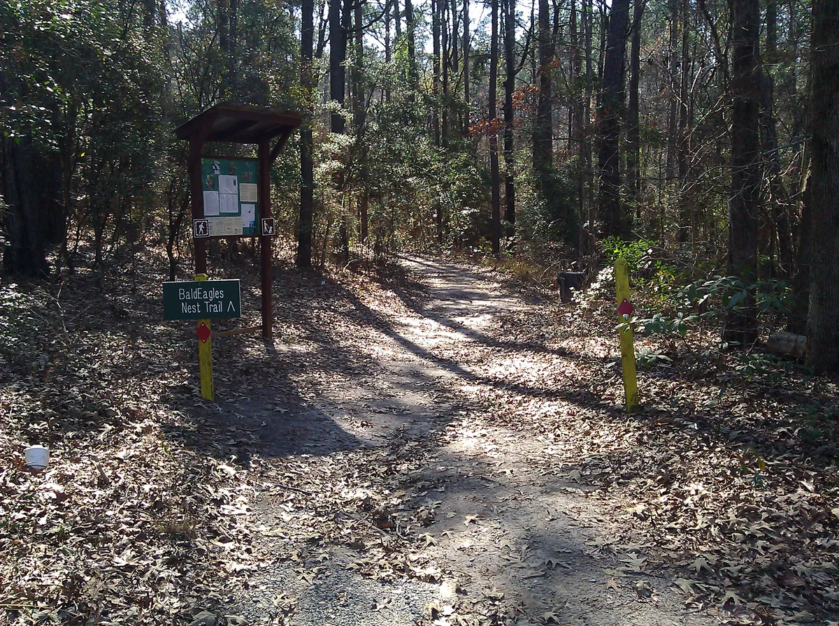
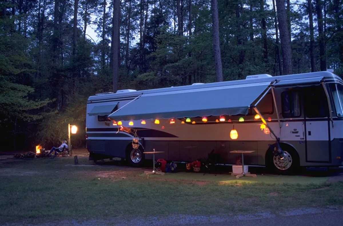
Before the reservoir, this stretch of the Sabine River was already a place people argued over and ultimately left alone. Toledo Bend changed that calculus in 1966, when Louisiana and Texas jointly dammed the Sabine and created 185,000 acres of water — the fifth largest man-made lake in the country by surface area. What rose around it wasn't tourism infrastructure bolted onto scenery. North Toledo Bend's bass fishery drew people who needed a pier and a place to clean their catch. South Toledo Bend's bluffs became bald eagle nesting ground because the reservoir's fish population gave the eagles a reason to stay. Inland, A.J. and Nona Hodges had already transformed a stripped sandstone quarry into 4,700 acres of terraced gardens and a 225-acre lake — closed in 2018 when the state defunded it, reopened in 2024 under a nonprofit. Three parks, one engineered river. The water is the reason all of it exists.
In 1822, Colonel Zachary Taylor built Cantonment Jesup on the Sabine River to impose order on what had been, for sixteen years, genuinely ungoverned ground. The officers who served there — Taylor, Jefferson Davis, Robert E. Lee — would go on to define the next half-century of American history, and Fort Jesup itself staged the Army of Observation's move into Texas that ignited the Mexican-American War in 1846. When the United States won Texas, the fort lost its purpose and was abandoned the same year. Nearly a century later the same longleaf pine flats hosted the Louisiana Maneuvers — 500,000 soldiers across 3,400 square miles in 1941 — and by July 1943 Camp Polk held captured soldiers from the Afrika Korps. The base, renamed Fort Johnson in 2023, is still here. The ground keeps getting assigned new missions.
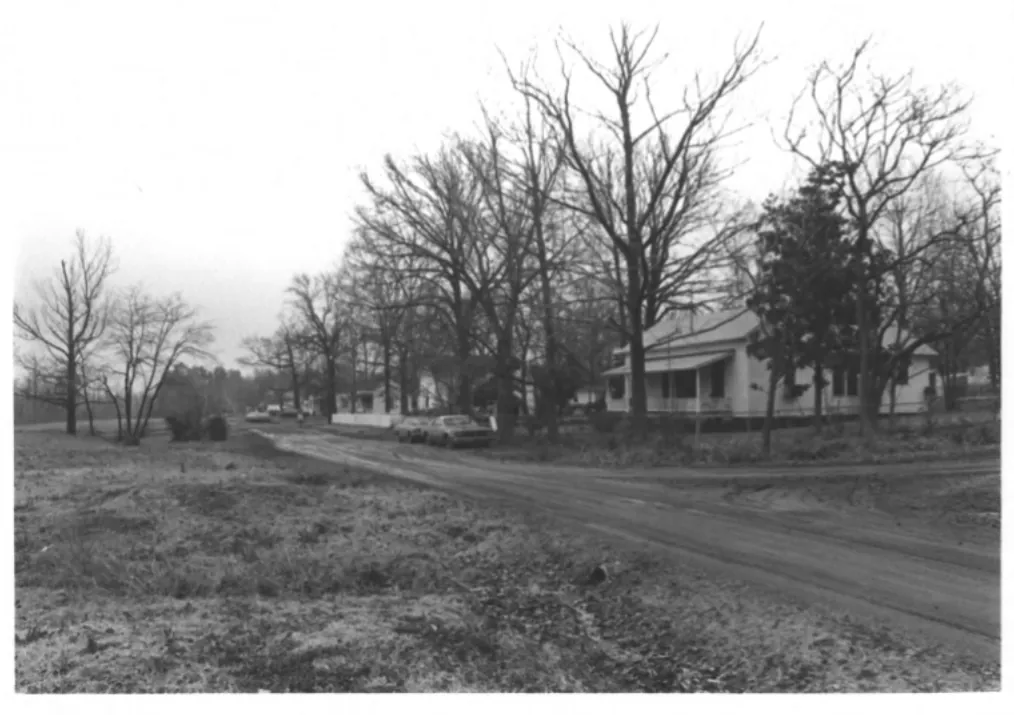
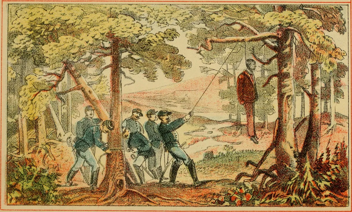
The Kansas City Southern Railway platted DeRidder in 1898 and named it for a Dutch investor's sister-in-law — a town conjured from longleaf pine and the promise of moving lumber south. By 1920 the population had reached 5,400, nearly every paycheck tied to sawmill and tie-mill work. When the longleaf ran out by the mid-1930s, the mills closed within months of each other. What the boom left behind was a grid, a courthouse square, a Kansas City Southern depot, and a jail built in collegiate Gothic style — the kind of architecture reserved for colleges and churches, here holding prisoners behind walls thirteen to twenty-one inches thick. That jail saw the only double hanging in Beauregard Parish history, on March 9, 1928. The gallows remain intact on the third floor. The historic district and the jail are both on the National Register. Ten minutes on foot shows you exactly how much town a timber boom could buy, and how much of it stayed.
Between 1806 and 1821, the Neutral Strip ran on what historians now call a 'shadow economy' — contraband, horse theft, counterfeit coin, runaway slaves, and a steady stream of stolen cattle driven east from Spanish Tejas into American Louisiana. The most organized operation belonged to Pierre Humphries, a Baltimore-born privateer who set up a base camp near what is now Burr's Ferry on the Sabine and ran raiding parties as far south as the Gulf Coast. The romantic version — the version the 1930s WPA writers loved — has Jean Lafitte himself leading pack trains up from Barataria through the pine woods. The documentary record is thinner, but what's clear is that Lafitte's network used the Neutral Strip as a smuggling corridor to move tariff-free goods from his Gulf base to American buyers upriver. The ridges and creek bottoms that the Army now uses for training exercises were, two centuries ago, the preferred outlaw trails. There was also a grim side of this economy that the folklore tends to skip. Runaway slaves from East Texas and south Louisiana fled to the Neutral Strip because slave-catchers had no jurisdiction there, and some were recaptured by bandits who sold them back across the Sabine. The strip's lawlessness was liberating for some and deadly for others, and the modern highway historical markers rarely mention either side of that ledger.
In September 1941, three months before Pearl Harbor, the U.S. Army put half a million soldiers and 19 divisions into the pine woods of west Louisiana for the largest peacetime military exercise in American history. It was the final dress rehearsal for the war that everyone in Washington already knew was coming. George C. Marshall organized it. Dwight Eisenhower was the chief of staff of the 'Blue Army.' George Patton commanded a tank brigade and crossed the Red River on wooden pontoon bridges that the Army Corps of Engineers built in eighteen hours. Omar Bradley was there. Mark Clark was there. Walter Krueger was there. The Louisiana Maneuvers were the place where Marshall watched his officers in the field and decided which of them would get the big commands in Europe and the Pacific — and which would be quietly retired. More generals were promoted or sidelined based on what they did in those two weeks than in any other exercise in Army history. The physical footprint is still here. Camp Polk (now Fort Johnson) was built in June 1941 specifically to stage the maneuvers. Peason Ridge, 33,000 acres of live-fire training ground, was carved out by buying out three communities. The old pontoon-bridge site on the Red River has a monument. The Louisiana Maneuvers Monument in Leesville lists the units that fought the mock battles. If you drive any farm-to-market road in Vernon Parish, you are driving on ground where the men who won World War II learned how to do it.
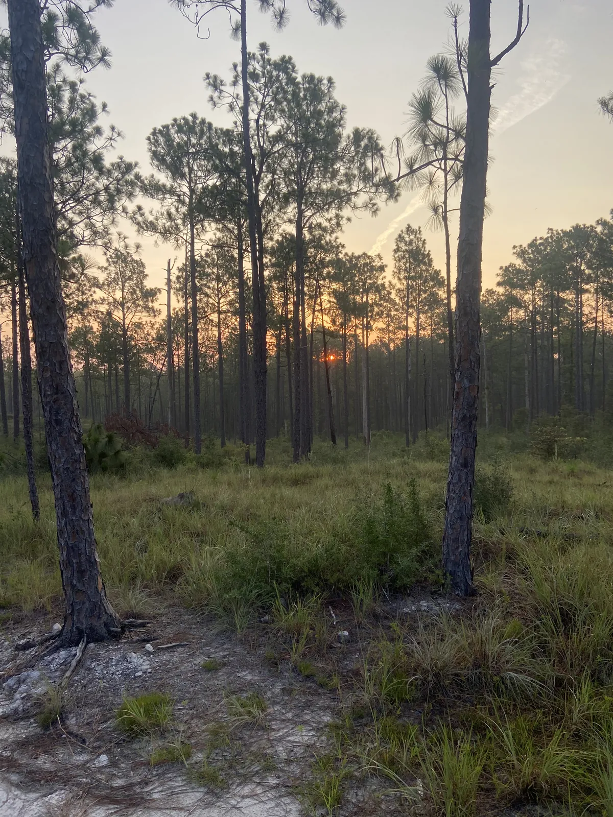
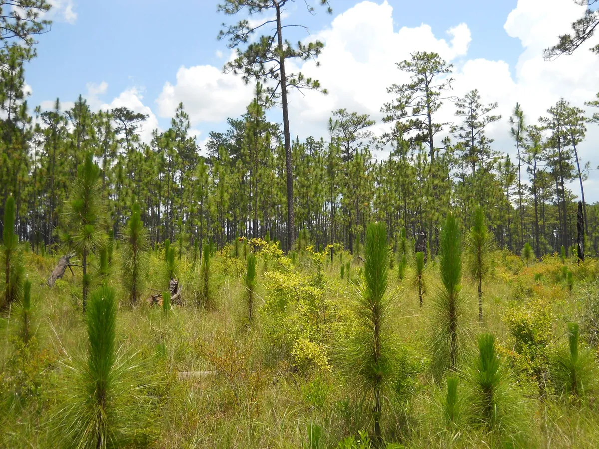
In 1890, the virgin longleaf pine forest covered almost the entire western third of Louisiana — millions of acres of trees that were two to three feet thick at the stump and straight as a plumb line. Northern timber capital arrived with the railroads around 1896, bought the land for $1.25 an acre, and set up mills at a speed that still reads like fiction. Within thirty years, the forest was gone. DeRidder, Pickering, Fisher, Bon Ami, Slagle, Peason, Cravens — each of these towns was a mill with a post office attached. The Pickering Lumber Company ran three shifts and peaked at 3,000 residents. Fisher was built as a company town by the Louisiana Long Leaf Lumber Company and is now the only surviving intact example in the state. The workforce was integrated in the mill yards (a rarity in the Jim Crow South), ethnically mixed (Cajuns, Anglos, Black workers, and recently-arrived Italians and Mexicans), and exploited equally by all of them. The Grabow Riot of 1912 near Merryville was the bloody high-water mark of the resistance. By 1935, the longleaf was essentially cut out. The mills closed within months of each other. Some were dismantled and hauled away on flatcars. Some towns were abandoned where they stood. The federal government, panicked about the wasteland the cut had created, began buying up the depleted land to create what is now the Kisatchie National Forest. The ghost of the cut is why most of the 'forest' you see in No Man's Land today is second-growth slash and loblolly — the original longleaf is still coming back one careful restoration plot at a time.
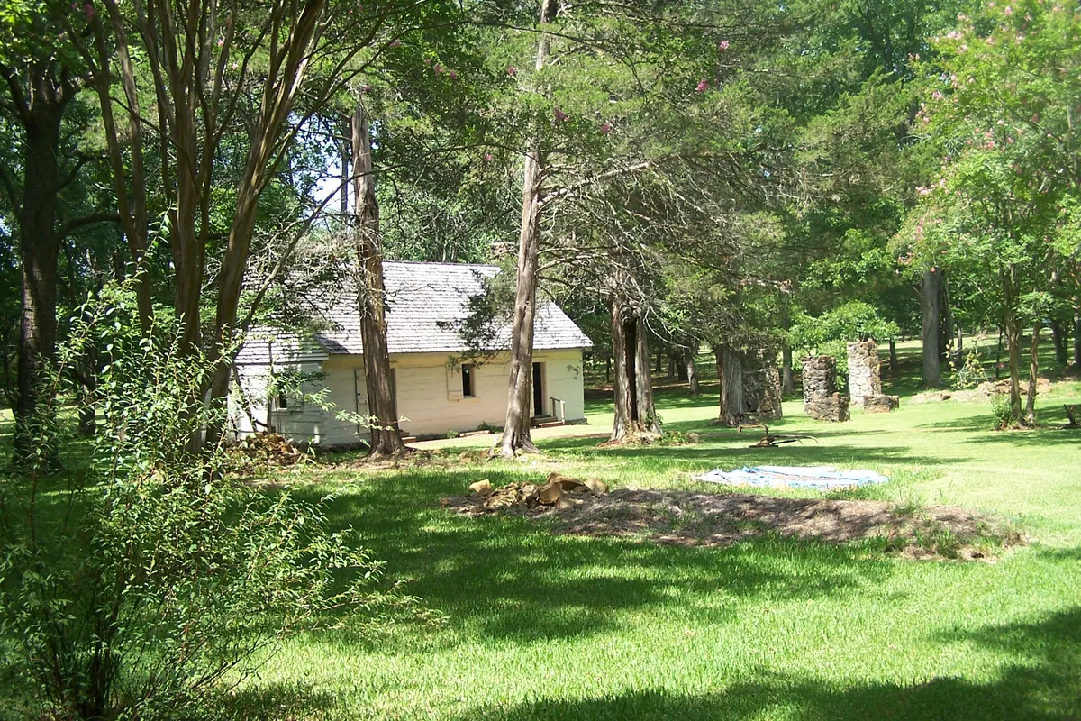
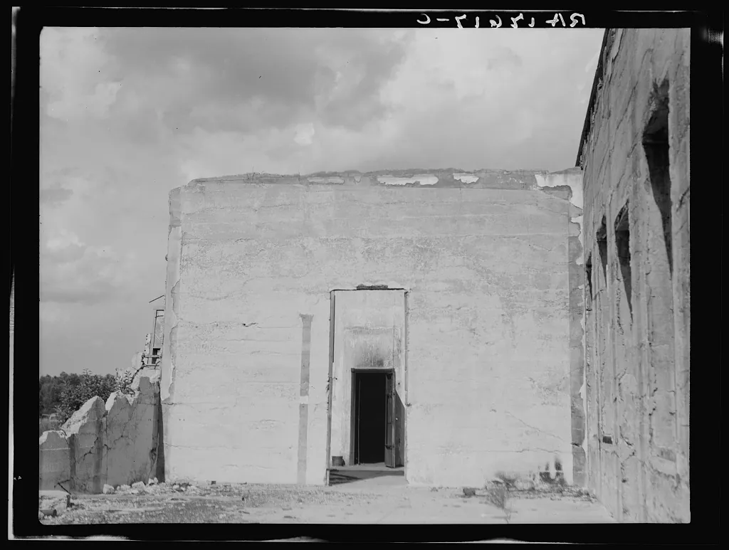
From 1729 to 1770, the capital of Spanish Tejas was in Louisiana. It sat on a low rise in what is now Sabine Parish, called Presidio Nuestra Señora del Pilar de los Adaes, and for forty years it was the easternmost outpost of the Spanish Empire in North America. It was also a logistical disaster. The road from Mexico City was 1,500 miles long. Supply trains took six months. The French garrison at Natchitoches, fifteen miles east, was closer and better-stocked, and the two sides ended up trading contraband with each other to survive. The Adaeseños — the Spanish soldiers, their families, and the Indigenous Adai people they lived beside — developed their own frontier culture: Spanish surnames, Catholic saints' days, corn tamales, and a creole Spanish that drifted away from the Castilian of Mexico. When Spain reorganized its northern frontier in 1773, the viceroy ordered Los Adaes abandoned and its residents force-marched to San Antonio. Many of them walked back within a year, scattered into the pine woods, and founded the communities that became Zwolle, Ebarb, Robeline, and Spanish Lake. Today Los Adaes is a State Historic Site — mostly archaeological, with low foundations and interpretive trails — and a National Historic Landmark. Most Americans have never heard of it. But the Sepulvado, Procell, Rivers, and Leone families in Zwolle still trace their line back to those 1720s soldiers, and the Zwolle Tamale Fiesta every October is a direct descendant of 300-year-old Adaeseño cooking.
When the United States bought Louisiana from France in 1803, nobody could agree where the western border was. Spain claimed the line ran along the Calcasieu River. The U.S. insisted it ran all the way to the Sabine. To keep the two armies from shooting at each other, General James Wilkinson and the Spanish commander signed the Neutral Ground Agreement in November 1806: the disputed strip between the Calcasieu and the Sabine — roughly the modern parishes of Vernon, Sabine, Beauregard, and part of Natchitoches — would belong to no country at all. No courts. No sheriffs. No taxes. No law. The agreement was supposed to last a few months. It lasted fifteen years. Every deserter, runaway slave, horse thief, counterfeiter, and filibustero in the Mississippi Valley figured out within about a week that the Neutral Strip was the one place in North America where no government could touch them. The pine woods filled up with outlaw camps. Jean Lafitte's crews used the ridge trails to smuggle contraband from the Gulf inland. The American and Spanish patrols took turns making half-hearted sweeps and leaving. When the Adams-Onís Treaty finally drew the border at the Sabine in 1821, the strip became American territory on paper. But the nickname stuck. A hundred years later, when the Army needed 200,000 acres to build Fort Polk, they chose this ground in part because it had never really been settled — there were fewer deeds to buy out. The outlaw legacy is why Louisianans still call this corner 'No Man's Land,' and why the culture here — self-reliant, suspicious of outsiders, unimpressed by authority — feels like nowhere else in the state.
On July 7, 1912, a group of striking sawmill workers gathered in Grabow, a timber camp near Merryville, to hear Arthur Emerson, president of the Brotherhood of Timber Workers. The Brotherhood was a radical union affiliated with the Industrial Workers of the World — and, crucially, the only racially-integrated labor union in the early-20th-century South. Galloway Lumber Company had locked out its striking workers and hired private guards. What happened in the next ten minutes is still disputed. Somebody fired a shot. The guards opened up with rifles from the cookhouse. The strikers fired back. When the smoke cleared, three workers and one company guard were dead and more than forty were wounded. Sixty-five union men were arrested and charged with murder, including Emerson himself. The trial in Lake Charles the following year acquitted all of them — a stunning outcome that historians still read as the jury's quiet verdict on how the mill owners had run the parish. But the acquittal was hollow. The Brotherhood was broken. Galloway Lumber blacklisted anyone suspected of union sympathy, and the company and its allies drove the BTW out of Louisiana within a year. The integrated labor movement in the Southern timber country was finished for a generation. The Merryville Historical Museum keeps the surviving photographs, ledgers, and even recovered rifle cartridges from the mill yard. For anybody who grew up being told the South had no union history worth remembering, the Grabow Riot is the story that undoes the lesson.
Lost places
Happening this month
Before you go
St. Denis founded Natchitoches, held the Louisiana-Texas frontier for 40 years, and drew the line that became a state border.
Also in this region
No Man's Land is one of several areas in Natchitoches & No Man's Land.
Plan your trip
The only thing left to do is go.
Plan your visit
Editorial content compiled with AI assistance. Place details verified against public records.