
Top picks in Dauphin Island
The places most worth your time here.


Connect your Cour circle to see which places friends and family recommend here.
Connect Cour →Landmarks
15 places worth the detour

tap the eye to open · swipe or use buttons to browse
The French found a pile of human bones on the western shore in 1699 and called it Massacre Island. By 1707 they had renamed it for the Dauphin — heir to the French throne — and were using it as an…
Read the full storyReading
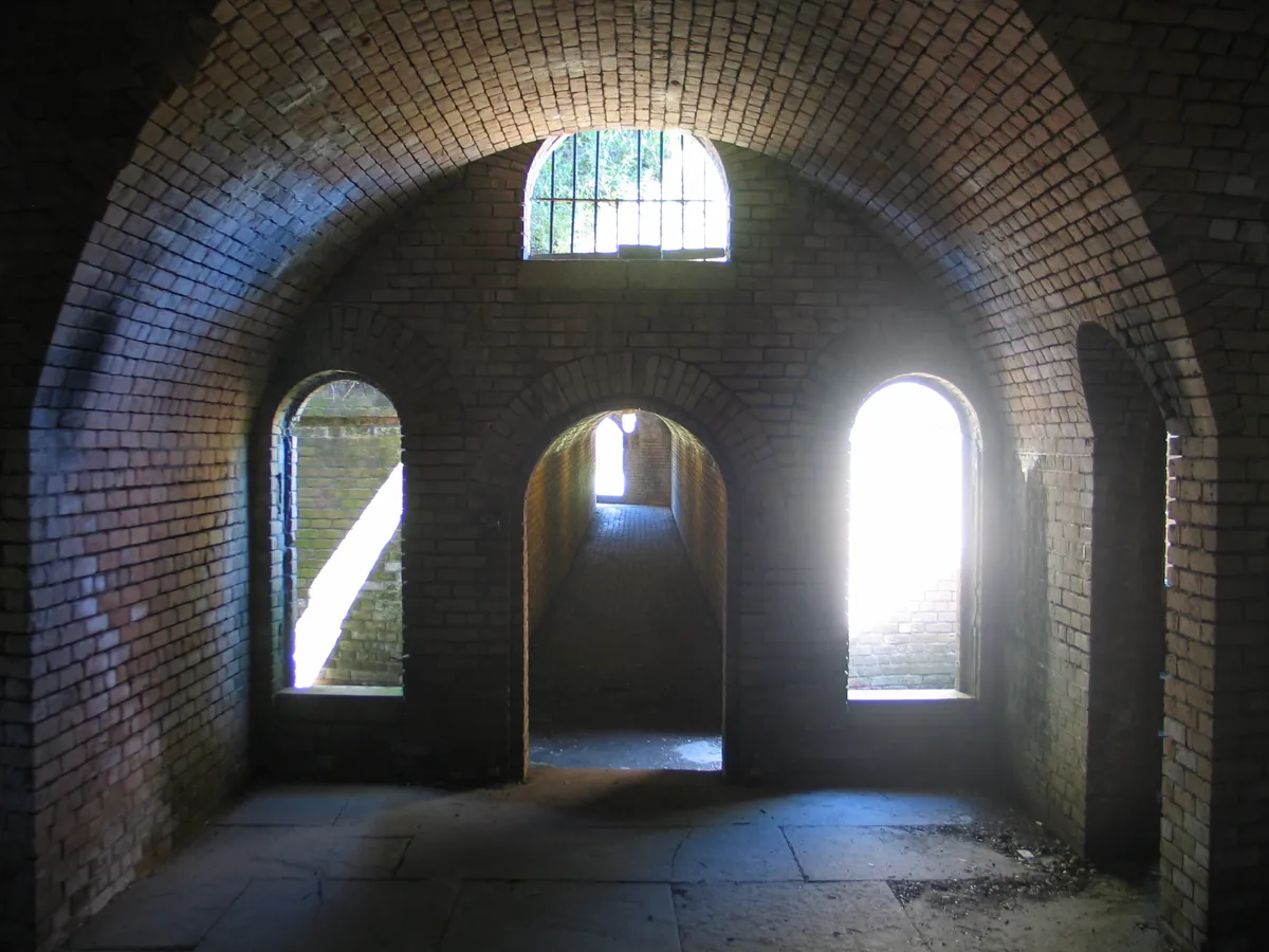
Fort Gaines went up at Dauphin Island's eastern tip starting in 1821, built to command the entrance to Mobile Bay. The engineers who designed it solved a problem every garrison commander faced: sanitation for approximately 400 soldiers, in a coastal fort with no running water. Their answer was the tidal latrine — one of the earliest of its kind in American military construction. Twice daily, on incoming and outgoing tides, Mobile Bay flushed the system automatically, routing waste directly to the bay with no manual maintenance required. Soldiers reached it through a tunnel running beneath the gun platforms and earthworks. The same coastal position that made Fort Gaines strategically essential — sitting at the mouth of the bay, commanding the water — was also what made this engineering possible. The fort is part of the self-guided tour. That tunnel, and the system it served, are still intact.
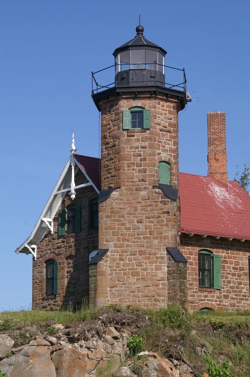
The island was called Massacre Island once, and then, sometime before Antoine de la Mothe Cadillac arrived around 1712, it had been renamed Isle Dauphine — for the heir to the French throne. By then it served as the primary port of entry for French Louisiana, the place ocean-going ships reached before the shallower bay could receive them. Cadillac, Governor-General of Louisiana, kept a home here, on ground the brief calls the first capital of the Louisiana Territory. The settlement is gone. The live oaks remain. You walk the same boulevard named for Jean-Baptiste Le Moyne de Bienville — founder of New Orleans and early colonial governor — and stand where the colony's first transactions happened. Four lighthouses have marked the bay entrance since 1838; storms and a Confederate demolition charge took three of them. The fourth still stands offshore, surrounded by water now, the island beneath it having all but disappeared. The Gulf takes what it wants. What endures here, it earned.
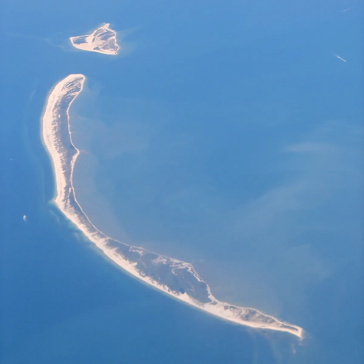
Dauphin Island is not a permanent thing. It's an argument the Gulf is having with the continent, and the Gulf is winning on points. Hurricane Frederick hit in 1979. Category 3. It destroyed the causeway bridge and 140 homes. Residents had to be ferried back to their own island. People rebuilt. In 2004, Hurricane Ivan cut a documented 1.35-kilometer breach through the island's west end. A year later, Katrina — which made landfall far to the west — sent its surge east across the Gulf. The storm's eye never crossed Dauphin Island. It didn't need to. The surge destroyed 450 of roughly 500 homes on the west end, a 90 percent destruction rate, and opened a 1.5-mile gap where neighborhood streets had been. Some of the land under those houses washed into the Gulf permanently. Yale Environment 360 called it the unluckiest island in America. The island today is measurably smaller and differently shaped than it was before 2004. It is also migrating — northward, slowly, as barrier islands do, building on the bay side while the Gulf eats the south shore. Hurricane Sally came through in 2020 and cut off 500 homes. People rebuilt again. They always do here. What that says about the island, you can decide.
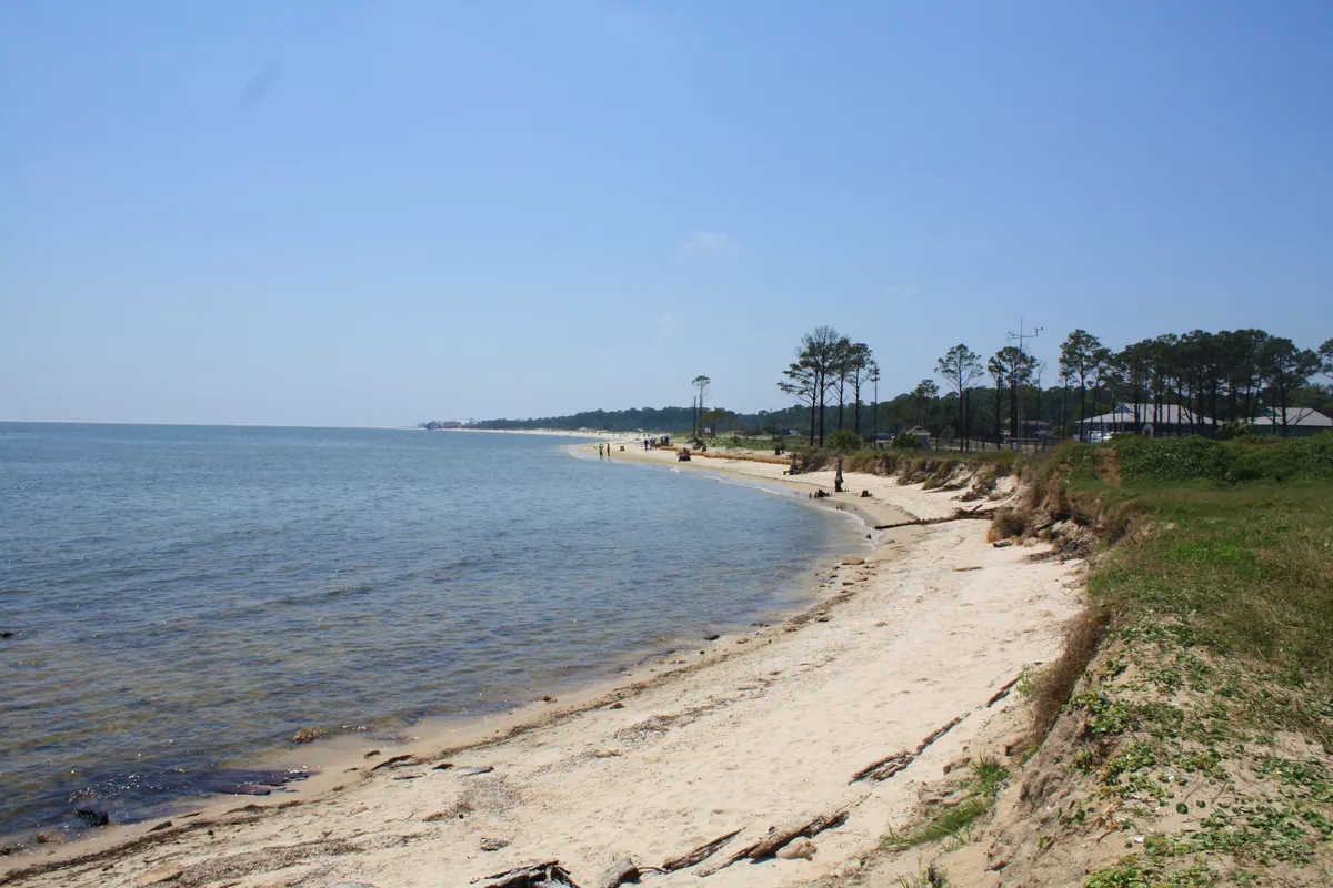
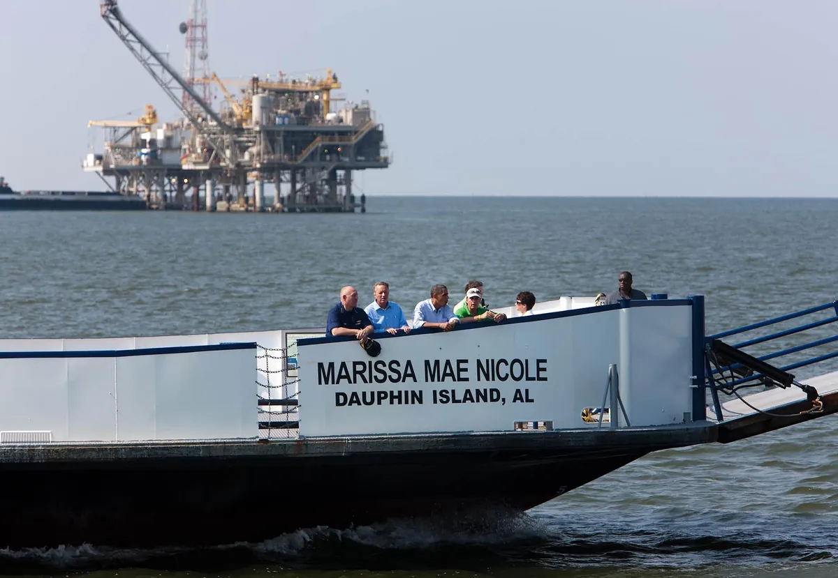
The water at Dauphin Island is not turquoise. It is not the postcard blue of Destin or the sugar-white Gulf Shores. The Gulf here is brown, or green-brown, or on a good day a murky jade that still won't let you see your feet past your knees. This is not a flaw. It's geography. The Mobile River drains a 44,000-square-mile watershed — parts of Georgia, Tennessee, Mississippi, and most of Alabama — through the Mobile-Tensaw Delta into Mobile Bay. The bay carries that load to the Gulf. When conditions are calm you can see the plume extending south, the dark river water spreading over the lighter salt water. Dauphin Island sits at the mouth of that system. The sediment is always there. At night, stand on the south shore and look out over the Gulf. The lights you see offshore — flickering orange and white on the horizon — are not boats. They are oil platforms. The northern Gulf of Mexico is an oil field, and the infrastructure is close enough to shore to be visible. The tourism brochures don't mention this. But it's honest. The Gulf that gave Dauphin Island its fishing economy also gave it the petroleum economy just beyond the waterline. The murky water and the oil lights are the same story: this is a working coast, not a beach resort. It looks like what it actually is.
When Pierre Le Moyne d'Iberville's expedition arrived in 1699, they found a pile of bones on the western shore. Hundreds of them, human, bleached and scattered. Iberville named the place Île Massacre — Massacre Island — and moved on. The bones were not from a massacre. They were from a burial. The Pensacola people had been coming to this island for centuries, harvesting oysters in the winter and spring, burying their dead here. A hurricane had exposed the burial, scattering the bones across the sand. Iberville saw catastrophe and named it accordingly. Eight years later, the French renamed the island for the Dauphin — heir to the French throne. The massacre name disappeared from the maps. The bones were still there, under the shell middens, waiting. Archaeologists confirmed the full story in 1990 when Gregory Waselkov of the University of South Alabama excavated Indian Mound Park and documented the oyster-steaming pits, the seasonal camp layers, the centuries of careful use before any European gave the place a name. The mounds are still there. The first European name for this island was based on a misreading. The thing that was actually there — a thousand years of people coming to fish and eat oysters — outlasted it.
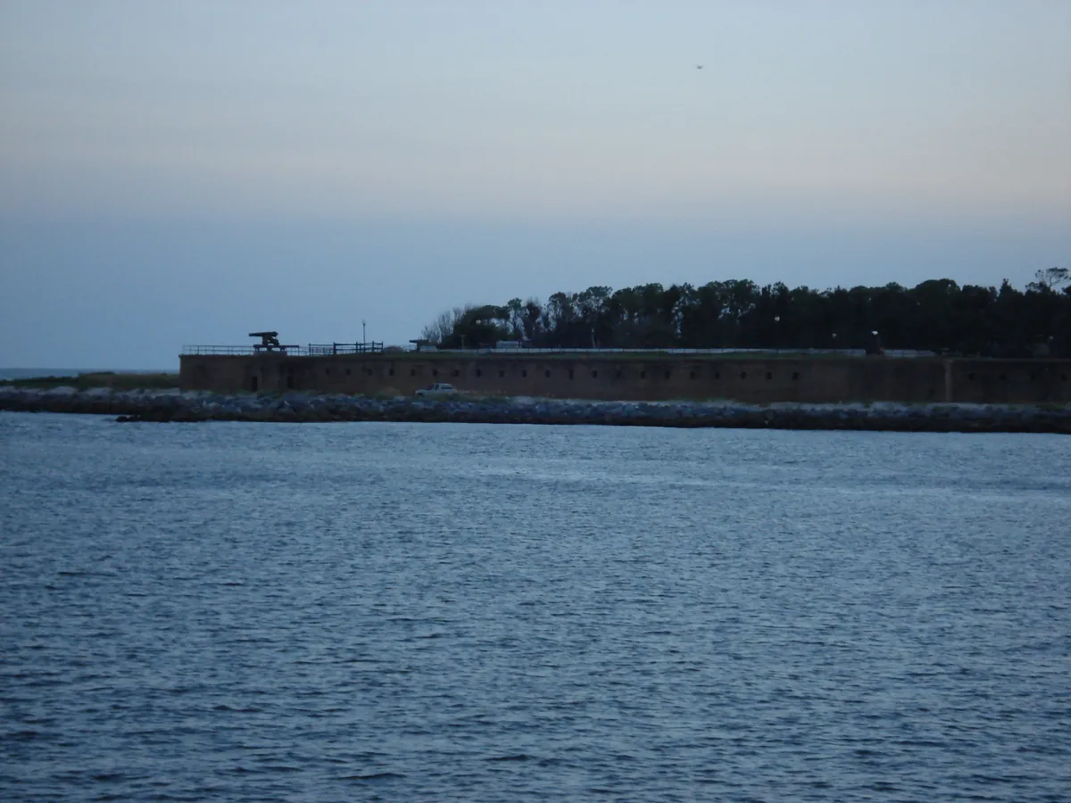
The ferry leaves from the shadow of Fort Gaines. You drive your car onto a flat-bottomed boat, and for forty minutes you are in the middle of Mobile Bay, moving between the two forts that have faced each other across the channel for 160 years. Fort Morgan is ahead of you. The water is the same water Farragut's fleet ran on August 5, 1864, under fire from both forts and through a field of Confederate mines. The battle is over. The crossing still feels like something. The ferry is operated by the Alabama Department of Transportation — twenty-eight vehicles, forty minutes, year-round except major holidays. On the Fort Morgan side, you're in Baldwin County. Fort Morgan State Historic Site is right at the landing. From there, AL-180 runs south along the peninsula through Gulf Shores, Orange Beach, and Perdido Key to the Alabama-Florida state line, where a roadhouse called the Flora-Bama has been holding down the border since the 1960s. If you drive the whole length of the Alabama Gulf Coast in a single day — starting at a Civil War fort, crossing the battlefield by ferry, ending at a dive bar on the state line — you've done something worth doing. The ferry is not the fast way to get anywhere. That's the point.
Before you go
A Gulf Coast PI novel set squarely on Dauphin Island — smugglers, bad politics, and the specific weight of a forgotten girl.
Islanders who built on dunes, moved after storms, and kept building — this is the place before you see it.
Plan your trip
The only thing left to do is go.
Plan your visit
Editorial content compiled with AI assistance. Place details verified against public records.