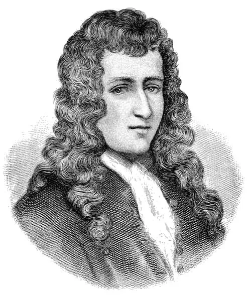
In April 1682, La Salle reached the mouth of the Mississippi and claimed all the land it drained for France, naming it Louisiana for King Louis XIV. That single declaration created the political entity that became the state of Louisiana and reshaped the map of North America. Everything upriver — New Orleans, Baton Rouge, St. Louis, Minneapolis — exists in its current form because of what La Salle declared at this spot.
The French founded New Orleans in 1718, selecting the site for its strategic position along the Mississippi and its access to Lake Pontchartrain via Bayou St. John. Throughout the nineteenth century, New Orleans was the largest port in the Southern United States, exporting most of the nation's cotton and farm products to Western Europe and New England. The claim La Salle made at the mouth of the river in 1682 determined who controlled the Mississippi River Valley and who would build that port.
The monument in southern Plaquemines Parish marks the approximate site of the claim. It is remote. Accessible via LA-23 south. The drive itself is part of the experience — the land narrows and the river dominates. You go to see what La Salle saw, to stand where the continental interior meets the Gulf, and to understand that a claim made here reshaped a continent.
- ·In April 1682, La Salle reached the mouth of the Mississippi and claimed all the land it drained for France — naming it Louisiana for King Louis XIV.
- ·That single declaration created the political entity that became the state of Louisiana and reshaped the map of North America.
- ·Everything upriver — New Orleans, Baton Rouge, St. Louis, Minneapolis — exists in its current form because of what La Salle declared at this spot.
- ·The monument in southern Plaquemines Parish marks the approximate site of the claim.
- ·Remote location. Accessible via LA-23 south. The drive itself is part of the experience — the land narrows and the river dominates.
Memories
Editorial content compiled with AI assistance. Place details verified against public records.