They called it the Hurricane Highway, and that was exactly what it became.
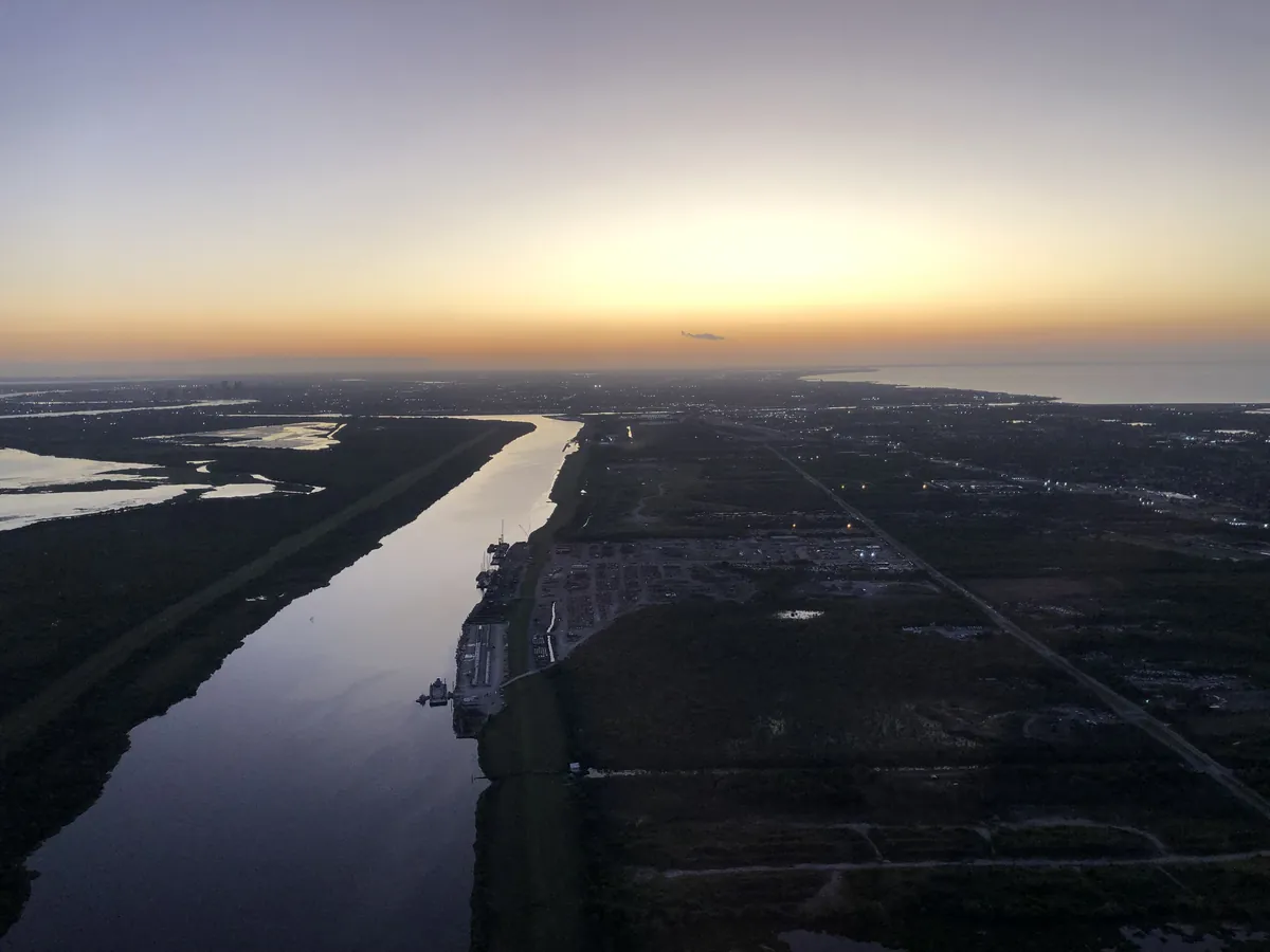
MRGO — the Mississippi River Gulf Outlet — was a 76-mile shipping channel completed in 1965 to provide a shortcut from the Gulf to the Inner Harbor. The channel was barely used for shipping. What it did was steadily destroy 27,000 acres of wetland buffer that had protected St. Bernard Parish from storm surge. New Orleans was built on an improbable geography — river, lake, marsh, Gulf — and wetlands were the city's armor. MRGO stripped the armor away.
On August 29, 2005, Katrina pushed a 25-foot storm surge through MRGO directly into St. Bernard Parish. Virtually every structure was damaged or destroyed. The parish population dropped from 67,229 in 2000 to 35,897 in 2010 — a 47% decline. Half the people gone.
Congress deauthorized MRGO in 2009. A 1.8-mile surge barrier now blocks the channel. By 2020, St. Bernard was the fastest-growing parish in Louisiana — the comeback story of the Katrina era.
The MRGO corridor is still visible on satellite imagery as a straight-line scar through the marshes east of New Orleans. You can see it from the air: the clean geometry of hubris cutting through organic land. What you cannot see from above is what came after — the people who stayed, the people who returned, the refusal to let that scar be the last word.
- ·MRGO — the Mississippi River Gulf Outlet — was a 76-mile shipping channel completed in 1965 to provide a shortcut from the Gulf to the Inner Harbor.
- ·The channel was barely used for shipping but steadily destroyed 27,000 acres of wetland buffer that had protected St. Bernard from storm surge.
- ·On August 29, 2005, Katrina pushed a 25-foot storm surge through MRGO directly into St. Bernard Parish. Virtually every structure was damaged or destroyed.
- ·The parish population dropped from 67,229 (2000) to 35,897 (2010) — a 47% decline.
- ·Congress deauthorized MRGO in 2009. A 1.8-mile surge barrier now blocks the channel.
- ·By 2020, St. Bernard was the fastest-growing parish in Louisiana — the comeback story of the Katrina era.
- ·The MRGO corridor is visible on satellite imagery as a straight-line scar through the marshes east of New Orleans.
Memories
Editorial content compiled with AI assistance. Place details verified against public records.