Top picks in Alexandria
The places most worth your time here.
Connect your Cour circle to see which places friends and family recommend here.
Connect Cour →Landmarks
52 places worth the detour
tap the eye to open · swipe or use buttons to browse
Long before anyone drew a parish line, this was a crossing. The Caddo and Avoyel peoples used the rapids on the Red River as a natural ford and a trading site. The rapids gave Rapides Parish its…
Read the full storyTours
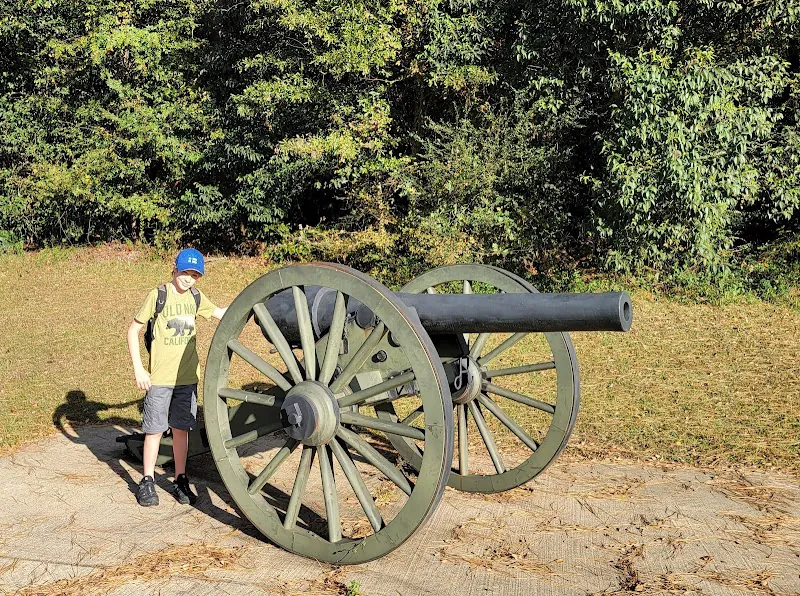
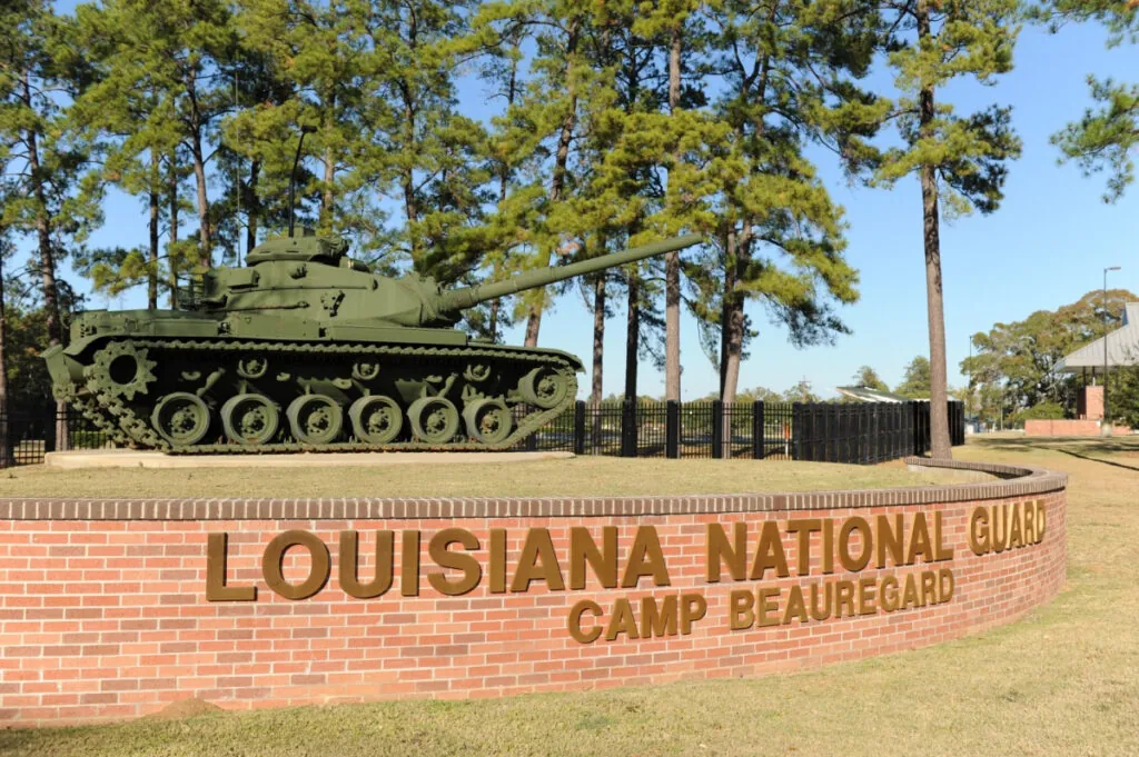
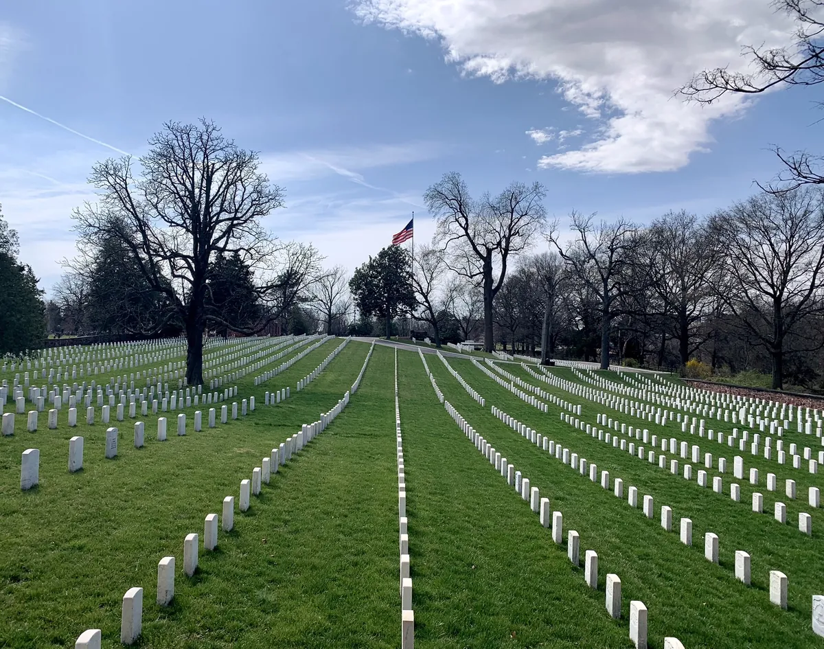
The 1864 Red River Campaign is the reason Alexandria has almost no antebellum buildings and the reason it has a national cemetery. Lt. Col. Joseph Bailey dammed the Red to float Porter's grounded gunboats over the rapids; Banks's retreating army torched the town. Alexandria National Cemetery, established 1862, is one of the original fourteen. Camp Beauregard later staged the 1940–41 Louisiana Maneuvers — Eisenhower, Patton, and Bradley running roughly 400,000 troops across the same flatlands. The army never really left.

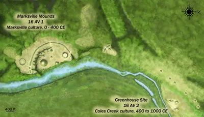
Avoyelles Parish is Tunica-Biloxi country, and the drive moves through 2,000 years of continuous occupation. The Marksville mounds, built between 100 BC and 400 AD, are a National Historic Landmark on ancestral ground the tribe still governs — the Paragon Casino and tribal museum sit on the same land, funded by the sovereignty the federal government finally recognized in 1981. The Hypolite Bordelon House, a French Creole raised cottage built around 1800, marks the later French settlement layer. Fort DeRussy was captured and destroyed twice in the 1864 Red River Campaign. The mounds outlasted both empires.
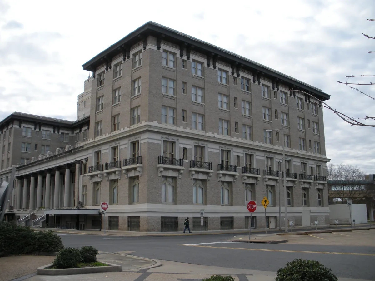
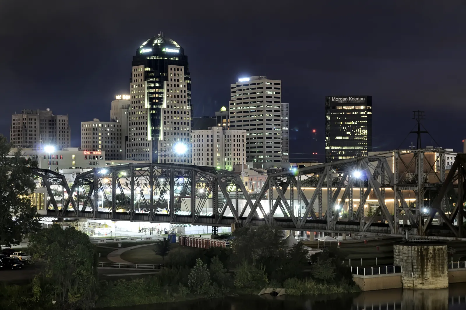
Almost nothing downtown predates May 1864, when Nathaniel Banks's retreating Union army burned twenty-two blocks in an afternoon. What rebuilt itself was a railroad and timber town — and the walk reads as that second city. The Hotel Bentley went up in 1907 on lumber-baron money; the Rapides Parish Courthouse, a seven-story Art Deco slab finished in 1940 for $588,825, is still the tallest thing on the skyline. River Oaks Square fills a donated 1899 home with 25 working studios. The fire is the gap the rest of the block fills.
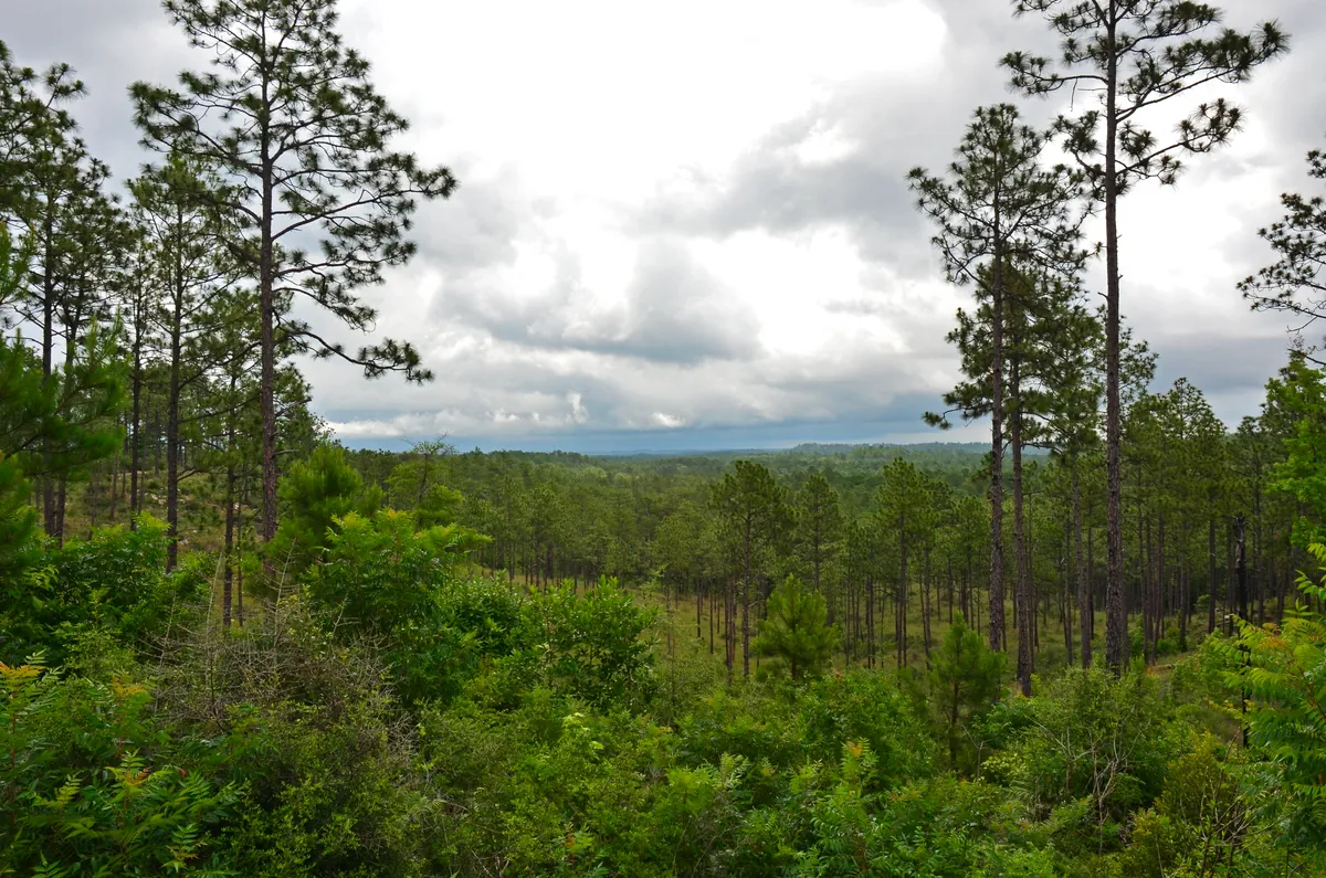
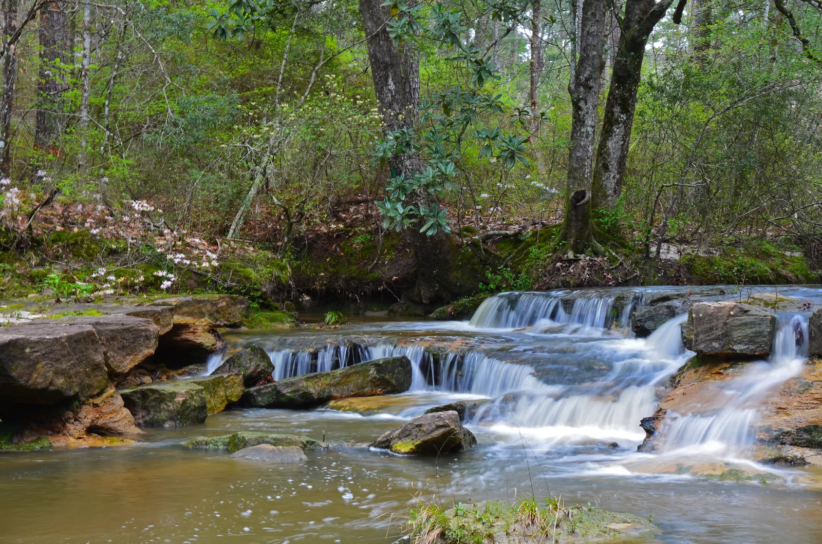
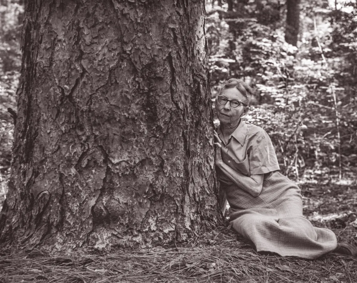
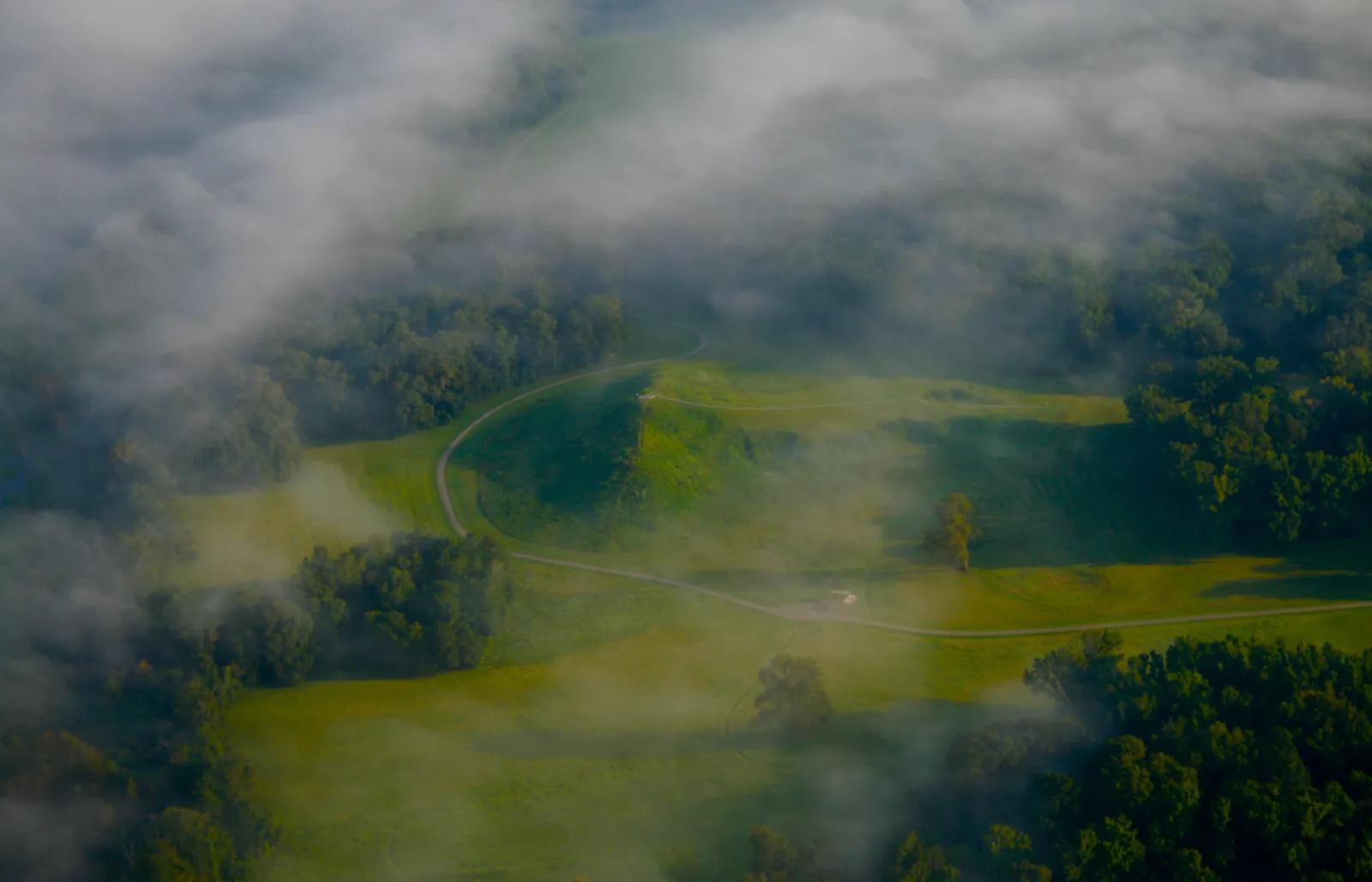
Kisatchie is the only national forest in Louisiana, and the Pine Hills are the only place in the state where the ground actually rises — sandstone outcrops the rest of the coastal plain doesn't have. The Longleaf Vista loop crosses 1.5 miles of restored longleaf pine, the species that once covered 90 million acres of the South and was logged down to less than three percent. The Caroline Dormon Trail runs 10.5 miles through the forest she lobbied Washington to create in 1930 — the first woman forester hired by the U.S. Forest Service. Her work is the trail.
Reading
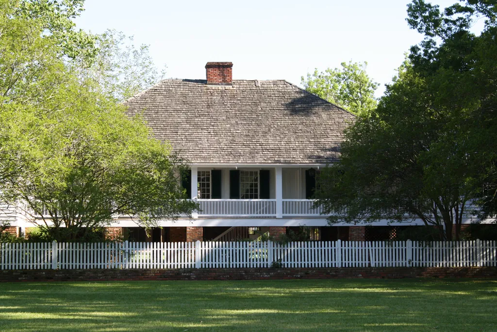
Alexandria was always the place where routes converged. The Caddo and Avoyel peoples used the Red River rapids as a ford and trading site long before anyone named the town; the rapids gave Rapides Parish its name. When Alexander Fulton laid out streets on his land in 1805, he was formalizing what geography had already decided. The Red River moved cotton and sugar south. The El Camino Real cut east-west through the piney woods. When the railroads arrived, they followed the same corridors. What the river port had been, the rail hub became. Kent Plantation House, built in 1800 and still standing, survived because it sat outside the twenty-two blocks Union troops burned in May 1864 during their retreat from the failed Red River Campaign. The town that rebuilt itself did so around iron and track — and when the Army needed open country to maneuver half a million troops in 1941, it found exactly that here.
Central Louisiana didn't plan its water. It built reservoirs for farms — irrigation for rice and soybeans, flood control for the flatlands — and then families started showing up on weekends, and the infrastructure became the recreation. Cotile Lake came first, the dam finished in October 1965 to water the fields around Boyce, fifteen miles northwest of Alexandria; Indian Creek Reservoir followed in 1970, built inside Alexander State Forest with irrigation and public use as joint mandates. Both have beaches, bathhouses, campsites wired for electricity. Kincaid Lake operates on different terms — 2,600 acres inside Kisatchie National Forest, sandstone-rimmed in a state that otherwise runs to mud and cypress, with resident bald eagles and a connection to the Wild Azalea Trail system. Three reservoirs, three different origins, the same outcome: in a region where the heat is serious and open water is rare, what was built for work became what people actually needed.
The Depression didn't pause Rapides Parish — it built it. The Civilian Conservation Corps dug a forty-six-acre lake by hand in Kisatchie, the kind of quiet water that still runs by its original rule: no motors, paddling and fishing only. Across the Red River in Pineville, Alexandria architect Errol Barron drew plans for a Dutch-style steel-frame town hall in 1931 — six municipal departments under one roof, the last consolidated building of its kind in Louisiana. And in 1940, the Rapides Parish Courthouse rose seven stories at 701 Murray Street in Art Deco concrete, finished at a cost of $588,825, with a bas-relief of Moses and law books on the facade. Three projects, one decade. What the era left here wasn't ruin — it was infrastructure, civic architecture, and a lake that still does exactly what it was built to do.
Between 1907 and 1927, the largest sawmill west of the Mississippi ran full tilt in the longleaf pine country outside Alexandria — a company town called Fullerton, population five thousand, with electricity, hospitals, and theaters all running on the sound of those blades. When the timber played out, the town emptied. What the brief around Kisatchie makes plain is the scale of what happened here: Louisiana logged itself nearly bare, and in 1930 the federal government drew a boundary around 604,000 acres of cutover land to let it grow back. The mill that outlasted Fullerton — the Southern Forest Heritage complex — closed on Valentine's Day 1969. The workers left their lunch pails on the bench. Nobody came back for them. The longleaf pine those blades cut built Higgins landing craft in New Orleans during WWII. The forest that replaced the cut is still growing. Both facts belong to the same story.
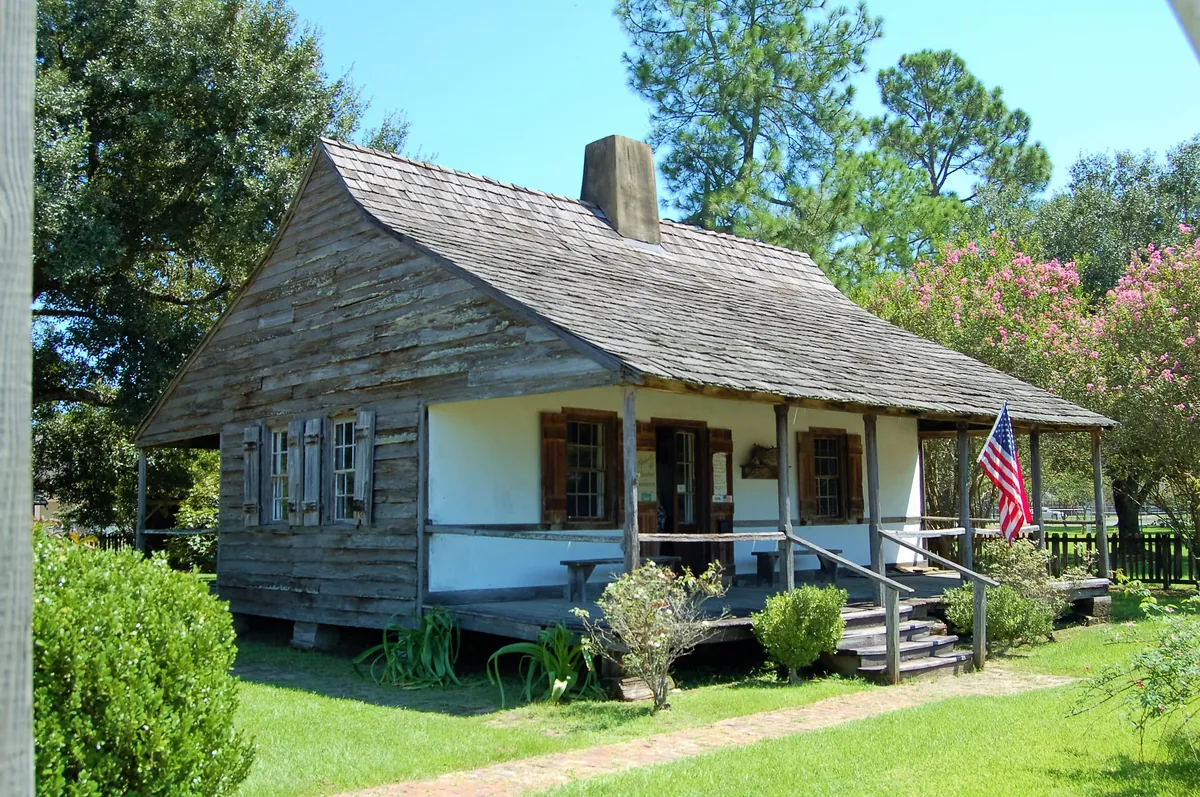
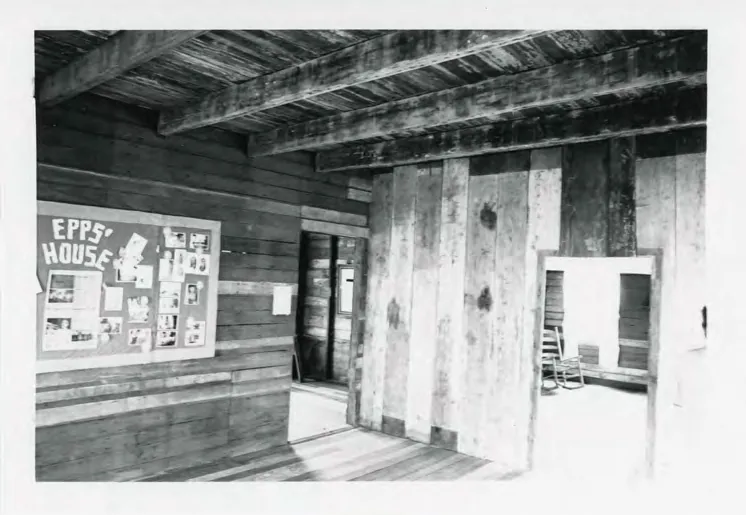
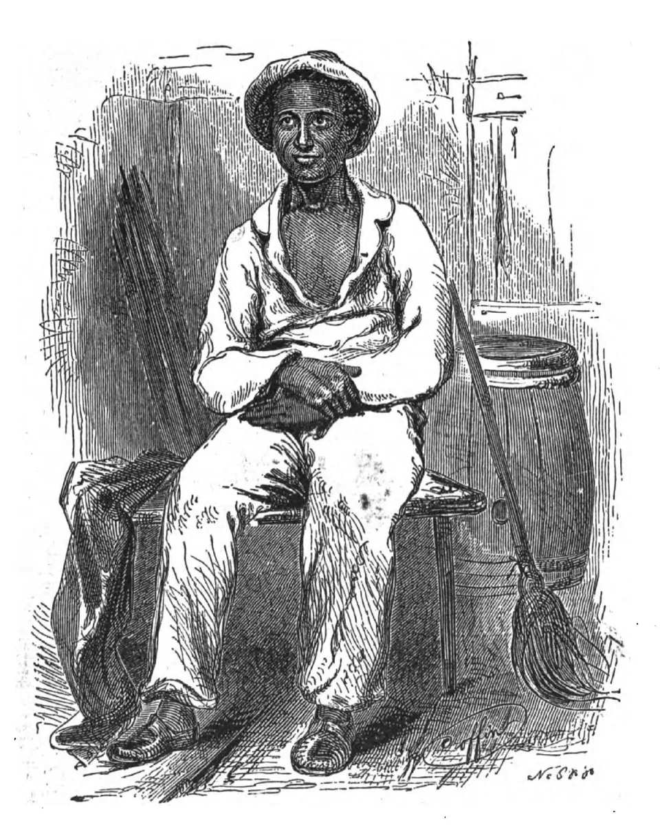
Three landmarks, three versions of the same economy. Kent Plantation House, completed in 1800 on Spanish land-grant soil, is the oldest standing structure in central Louisiana — its raised-cottage form built for heat and flooding, its six surviving outbuildings including a slave cabin and a detached kitchen that still runs open-hearth demonstrations the first Saturday of each month. Six miles south of Alexandria, Inglewood — also known in the record as Hard Times Plantation — holds a 1836 Creole main house, twenty-two support structures, and the same infrastructure of forced labor. The Edwin Epps house, originally on Bayou Boeuf, is where Solomon Northup spent ten of his twelve years enslaved, and where a Canadian carpenter named Samuel Bass finally got word north. Northup published his memoir in 1853. The house now sits on the LSUA campus, free to visit, the truth having become, as the record puts it, foundational.
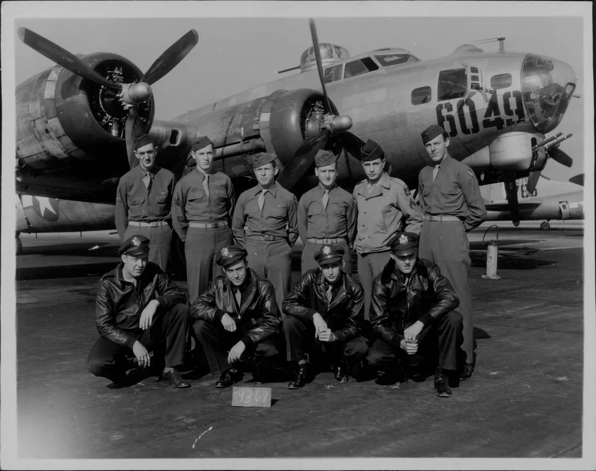
In the summer of 1941, the U.S. Army staged the largest peacetime military exercise in American history across 3,400 square miles of central Louisiana pine forest. Half a million soldiers — including future generals Eisenhower, Patton, and Bradley — tested new armor tactics, air-ground coordination, and supply chain logistics that would define the Allied campaigns in North Africa and Europe. Camp Beauregard and Camp Polk became the nerve centers. The Hotel Bentley served as officers' quarters. Local farmers found tanks parked in their cotton fields. The Maneuvers transformed Alexandria from a quiet river town into a military boomtown overnight, and the infrastructure — roads, airfields, barracks — reshaped the region permanently.
Solomon Northup was a free Black man from New York, kidnapped in 1841 and sold into slavery on the bayous of Avoyelles and Rapides parishes. His ten years of forced labor along Bayou Boeuf produced one of the most important American slave narratives ever written. The Edwin Epps House — now on the LSU Alexandria campus — is the actual structure Northup helped build for the man who enslaved him. The landscape Northup described still exists: the bayou bottoms, the cotton fields, the Creole architecture. Reading the memoir here, against the geography, is a different experience than reading it anywhere else.
Before Caroline Dormon, Louisiana had no national forest. Born in Saline in 1888, Dormon became the first woman employed by the U.S. Forest Service and spent decades lobbying Congress to protect central Louisiana's longleaf pine ecosystem. Her work led to the creation of Kisatchie National Forest in 1930 — 600,000 acres that today harbor Red-cockaded Woodpecker colonies and the state's most dramatic terrain. Dormon published six books on Louisiana plants and birds, painted botanical watercolors, and designed gardens. The 10.5-mile trail named for her threads through the forest she saved.
The Marksville Prehistoric Indian Site — a horseshoe-shaped embankment enclosing burial mounds dating to 50 B.C. — marks the beginning of a continuous indigenous story in Avoyelles Parish. The Tunica-Biloxi Tribe of Louisiana has called this land home for centuries, surviving colonization, displacement, and federal recognition battles. Today the tribe operates the Paragon Casino Resort and maintains the Tunica-Biloxi Cultural & Educational Resources Center. In 2022, stewardship of the Marksville site transferred to the tribe. It is one of the most complete examples of indigenous continuity anywhere in the lower Mississippi Valley.
Alexandria exists because the Red River has rapids here. The rock formations that gave Rapides Parish its French name forced travelers and traders to stop, portage, and resupply — creating a natural marketplace at the geographic center of Louisiana. The town incorporated in 1818, grew as a river port and crossroads, and never lost that strategic position. Interstate 49 now follows the same north-south corridor the Caddo and French traders used. Alexandria's centrality made it the staging ground for the Louisiana Maneuvers and keeps it the hub for the surrounding agricultural and timber parishes.

On May 13, 1864, retreating Union soldiers set fire to Alexandria. The blaze destroyed most of the town — homes, churches, businesses, the courthouse — leaving only a few structures standing. The burning came at the end of the failed Red River Campaign, after Union forces were defeated at Mansfield and Pleasant Hill. Retreating downriver, they found the Red River too low for their gunboats. Colonel Joseph Bailey engineered a temporary wing dam near Forts Randolph and Buhlow to raise the water level. The boats escaped. The town didn't. Almost nothing in downtown Alexandria predates 1864.
Happening this month
Before you go
Northup's memoir documents his kidnapping and enslavement on the Edwin Epps plantation near Alexandria—the very ground where a carpenter's courage sparked his rescue and freedom.
Tennessee Williams' only original screenplay, filmed in Alexandria and the river plantations. The Louisiana he imagined is the Louisiana you'll find.
Also in this region
Alexandria is one of several areas in North Louisiana.
Plan your trip
The only thing left to do is go.
Plan your visit
Editorial content compiled with AI assistance. Place details verified against public records.