Top picks in Roanoke
The places most worth your time here.
Connect your Cour circle to see which places friends and family recommend here.
Connect Cour →Landmarks
104 places worth the detour
Includes 2 ghost landmarks— places that existed here and don’t anymore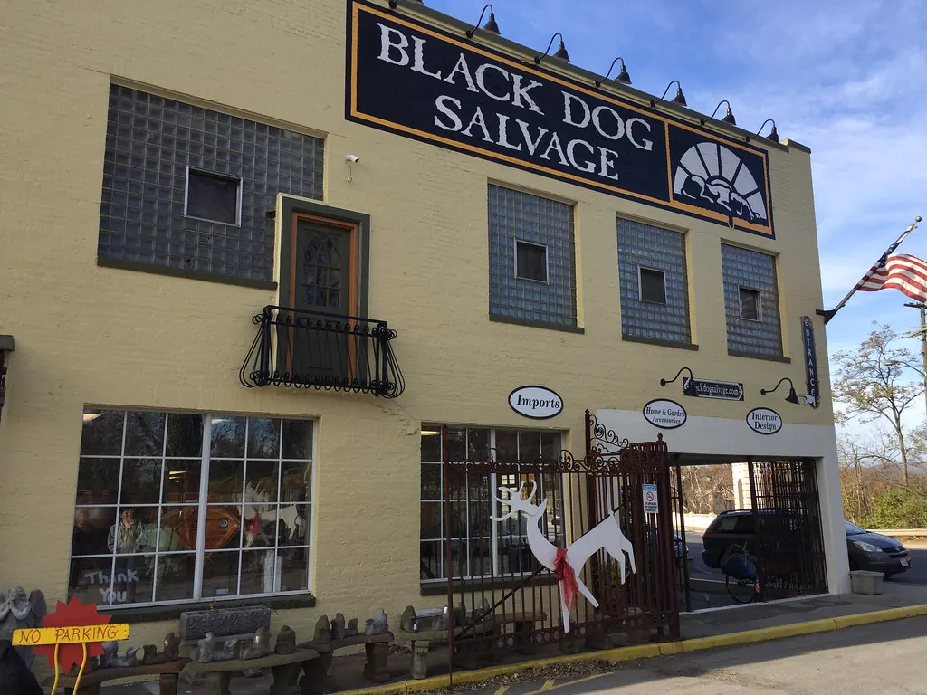

tap the eye to open · swipe or use buttons to browse
The valley belonged to the Tutelo and Monacan peoples first. For centuries before European contact, the Siouan-speaking nations of the Blue Ridge hunted the forests and fished the headwaters of the…
Read the full storyTours
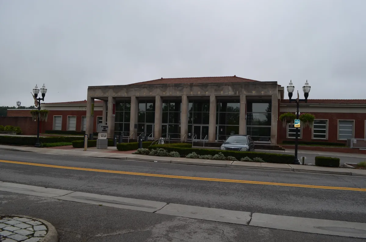
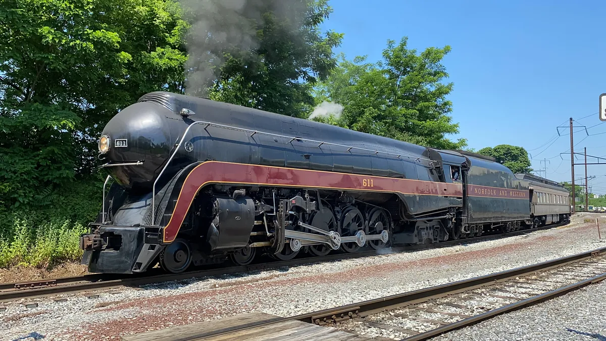
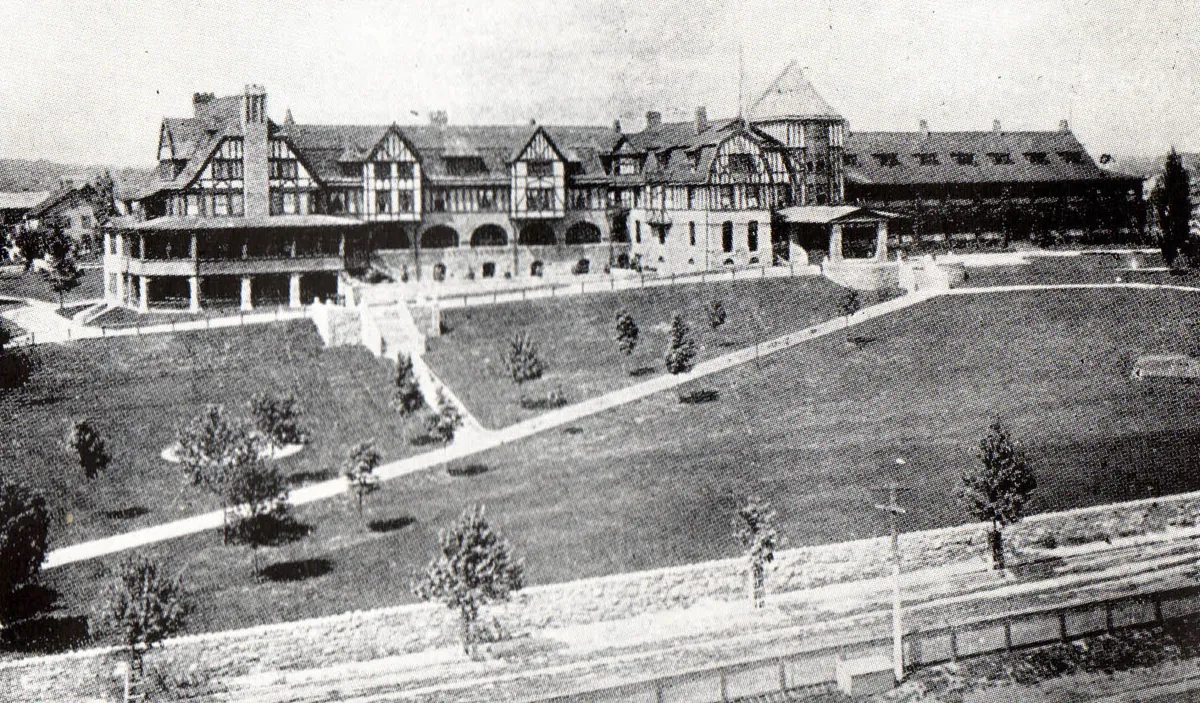
In 1882, a village of 500 people renamed itself and became a city of 25,000 inside a decade — because the Norfolk & Western Railway chose it as a junction. This walk connects the headquarters where the decision was made, the photographer who captured the last steam era in haunting black-and-white, the museum that holds the surviving locomotives, and the hotel the railroad built for its executives.
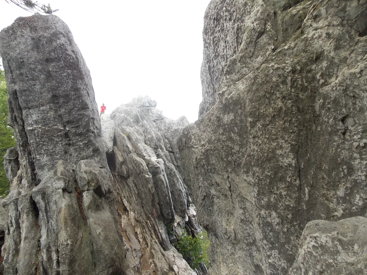
McAfee Knob is the most photographed spot on the entire Appalachian Trail, and all three trailheads of the Virginia Triple Crown sit within thirty minutes of downtown Roanoke. Dragon's Tooth is a 35-foot blade of Tuscarora sandstone reached by a scramble. Tinker Cliffs is a mile of exposed ridgeline at 3,000 feet with 270-degree views. McAfee is the flat sandstone shelf jutting over the Catawba Valley at 3,197 feet. No other city on the AT has this much ridge in its commute.
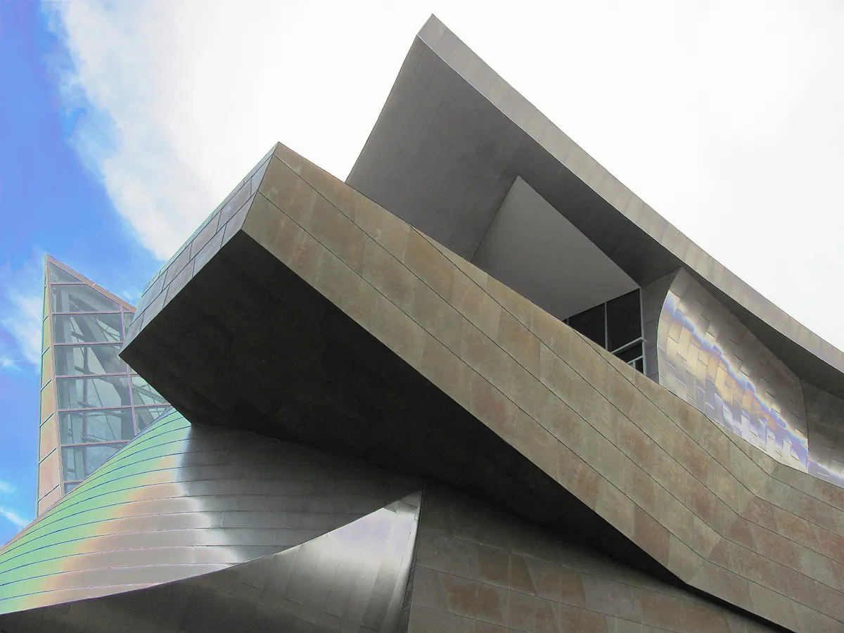
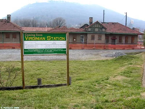
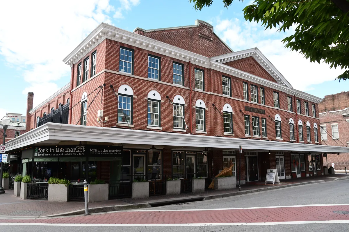
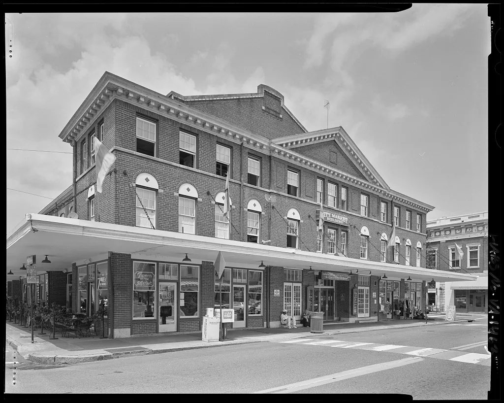
The Roanoke City Market has run continuously since 1882 — the oldest open-air market in Virginia and the spine of a downtown that does more with less than any small city in the South. opened in 2008, designed by Randall Stout, throws its zinc planes off the Norfolk Avenue corner. Center in the Square holds five museums on five floors of the old Heironimus department store. in the 1898 Norfolk & Western passenger station, holds the photographs of the railroad's last steam decade. Elmwood Park is where the city gathers.
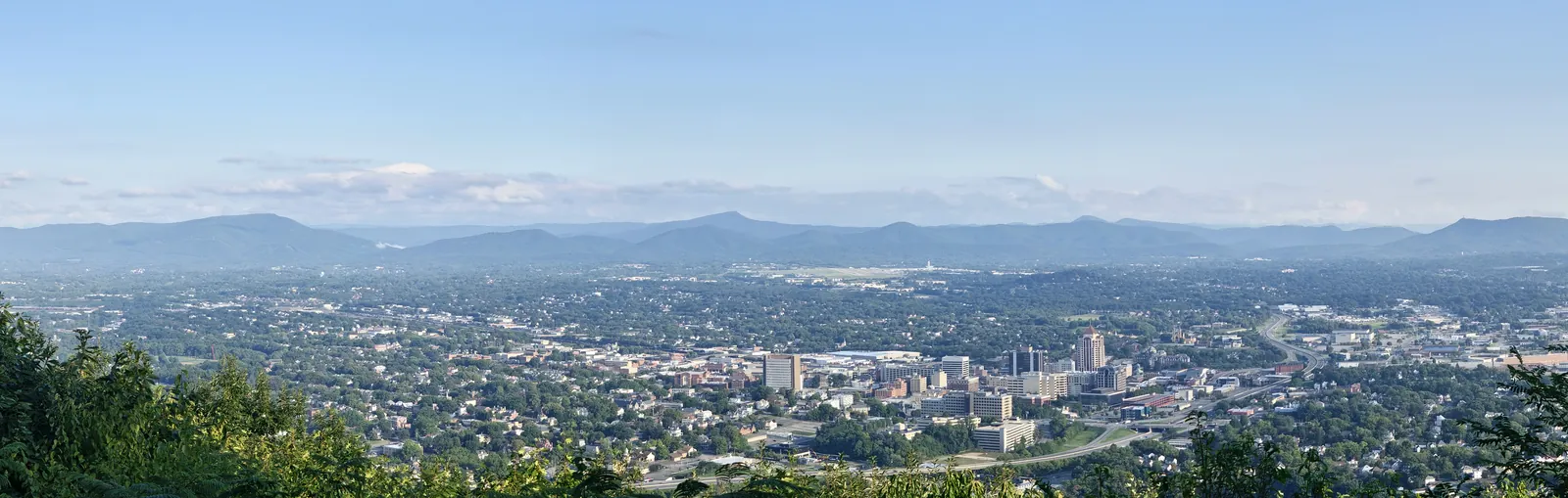
Start at the Mill Mountain Star — 88 feet of neon erected in 1949, visible from 60 miles, the only municipal star this size in America. Climb the Parkway to Roanoke Mountain's overlook for the long valley view. Explore Park sits where the Blue Ridge meets the Roanoke River, with an early 1700s log cabin reassembled stick by stick. Carvins Cove closes the day: 12,463 acres of municipal park, 60 miles of trail, a 630-acre reservoir that doubles as the city's tap. The Parkway runs 469 miles. Roanoke is the southernmost city on it big enough to pull off.
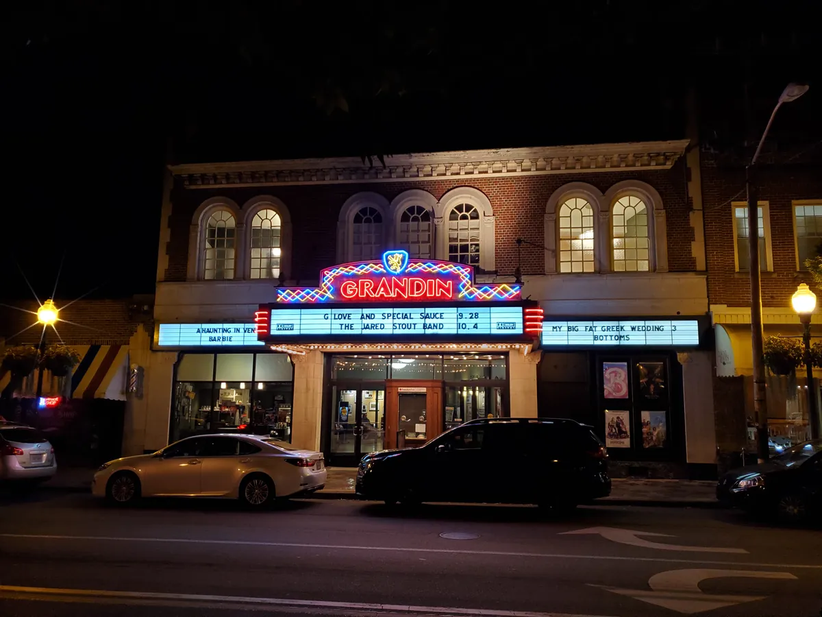
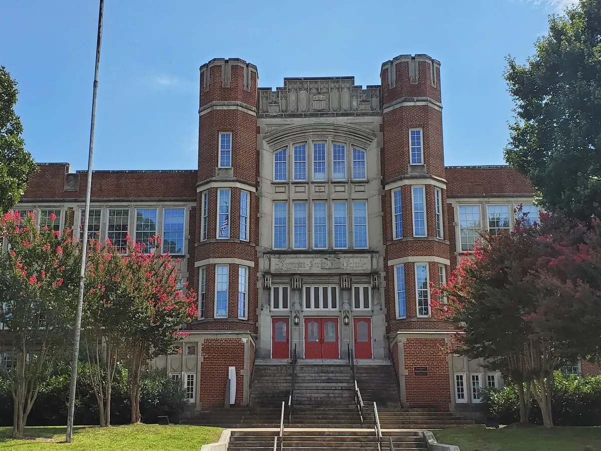
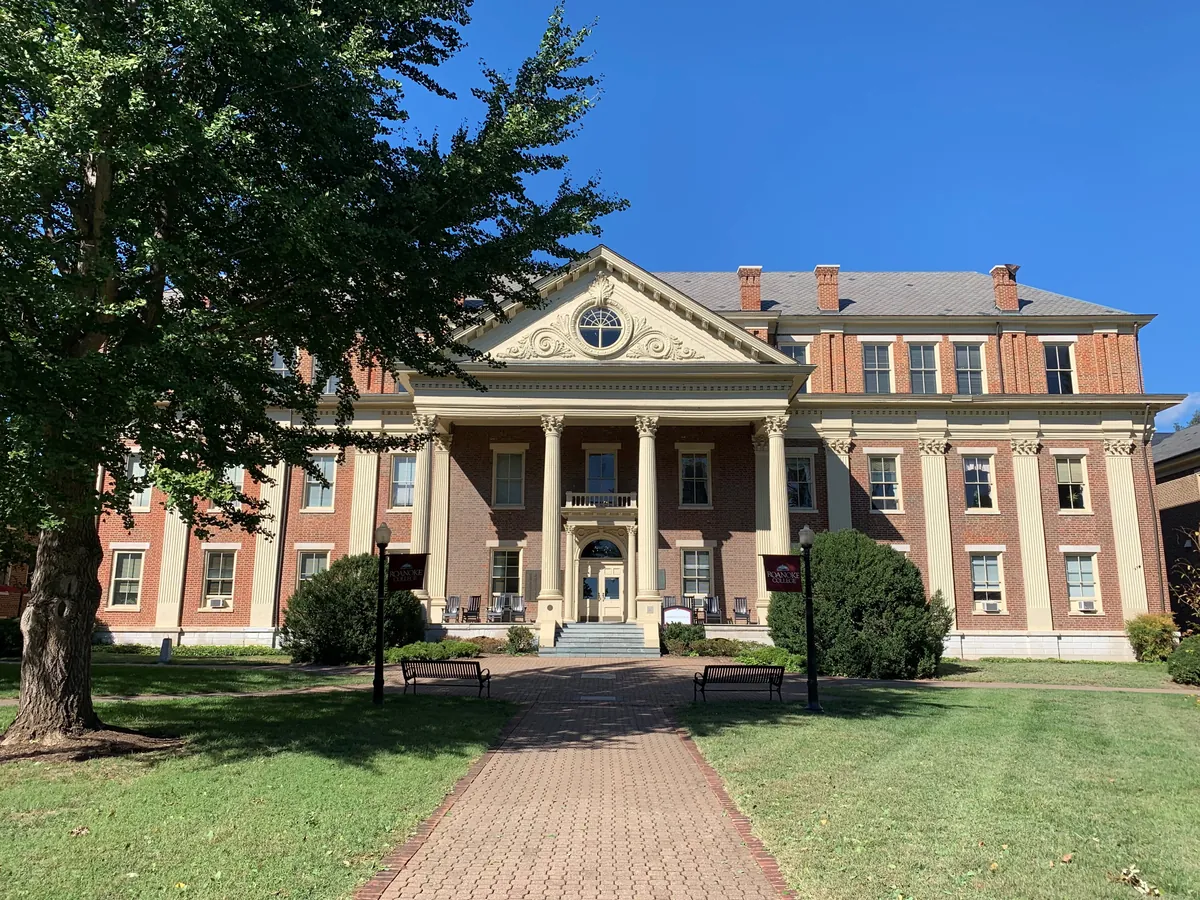
The neighborhoods south and west of downtown are where Roanoke lives when it's not performing for visitors. Old Southwest has the largest intact collection of late Victorian architecture in Southwest Virginia. Black Dog Salvage made architectural salvage into a television show. The Grandin Theatre has been screening movies since 1932. Roanoke College in Salem has been educating students since 1842. This is the residential city the railroad built.
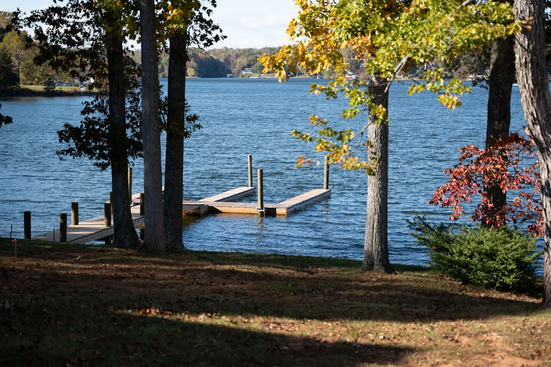
A small town of 3,200 sent its National Guard company to Normandy and lost 19 men in ten minutes — the highest per-capita D-Day loss of any community in America. The memorial built on the hilltop is devastating and specific. Then drive 20 minutes to Virginia's largest man-made lake and spend the afternoon on 500 miles of shoreline that most people outside the valley don't know exists.
Thomas Jefferson bought a 215-foot limestone arch from Lord Fairfax in 1774 and called it one of the most sublime works of nature. The Monacan walked under it for centuries before he held the deed. This loop pairs that arch with the river the railroad followed: a paddled section of the 45-mile Roanoke Blueway, then Carvins Cove — 12,000 acres and a 630-acre reservoir that supplies the city's tap water and doubles as its backyard wilderness. The arch is the headline. The water is why anyone stayed.
Reading
The Scottish-Irish settlers who followed the Great Wagon Road into this valley in the 1740s found blue mountains on every horizon and stayed. What they couldn't have known is that the mountains would outlast everything else — the salt licks, the railroad boomtown, the locomotive works. Roanoke exists because of location, and its backyard is the proof. McAfee Knob, a flat rock ledge at 3,197 feet, is the most photographed overlook on the entire 2,190-mile Appalachian Trail — thru-hikers call it the emotional midpoint of the Virginia section. Dragon's Tooth, a 35-foot spire of Tuscarora sandstone, demands hands on rock to reach the top. Apple Orchard Falls drops 200 feet down a cliff face near the Parkway's Virginia high point. Tinker Cliffs runs a mile along the ridge at 3,000 feet. The railroad shaped the city. The mountains were already here.
The railroad named Roanoke, built it in a decade, and left in 1982 when Norfolk and Western moved its headquarters to Norfolk and the manufacturing closures followed. What remained was the valley itself — the Appalachian Trail running through the county, Carvins Cove fifteen minutes from downtown, the Blue Ridge Parkway a half-hour south, the Roanoke River threading thirty miles of greenway through the city. The city rebranded itself the Outdoor Capital of Virginia in the 2010s, and the claim holds because the geography was always there: McAfee Knob, Tinker Cliffs, and Dragon's Tooth all sit within thirty minutes of downtown. The Mill Mountain Star, built in 1949 by merchants who decided to leave it up permanently, gave the city its older name — Star City of the South — visible from almost anywhere in the valley. One identity the railroad made. One the merchants kept. One the mountains always offered.
Gainsboro was founded in 1835, Roanoke's oldest community, and what the people there built under segregation came to be called Roanoke's Black Wall Street. Henry Street was the heart of it — hotels, theaters, restaurants, and professional offices lined the avenue, not by choice but because the law left no alternative. Louis Armstrong, Duke Ellington, and Ella Fitzgerald performed there. In 1921 a library opened in Gainsboro, the only public library for Black residents during segregation, and it still stands, restored, holding an African American heritage collection. Then Urban Renewal demolished 1,600 homes, 200 businesses, and 24 churches. Desegregation dispersed the rest without replacing what was lost — the pattern repeated across the South after integration. You walk what endured. The library, the surviving buildings on Henry Street, the Harrison Museum in a 1906 warehouse: the proof that a community built something the law tried to limit.
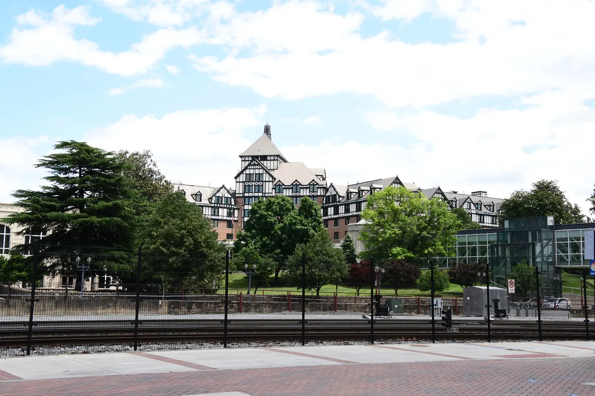
In 1882, the Norfolk & Western Railway chose a crossroads village of 500 people called Big Lick as its junction point, and the place agreed to become a city. Within a decade the population reached 25,000. The railroad built the shops, the hotels, the downtown grid — everything in a single generation by a single industry, earning the place its early nickname: the Magic City. By 1931 that momentum was visible in skyline form: a 12-story Art Deco headquarters tower, the tallest building in southwestern Virginia, its lobby murals still showing N&W operations to anyone who walks in off the street today. The railroad employed more people than any other company in the region for over a century. When it moved its headquarters out, the manufacturing closures followed. What remained was the architecture, the rolling stock preserved at the old freight station downtown, and a city that knows exactly what built it.
Lost places
Happening this month
Before you go
The Roanoke that the chamber of commerce didn't write. Harris digs out what got buried — read it before you decide what this city is.
Plan your trip
The only thing left to do is go.
Plan your visit
Editorial content compiled with AI assistance. Place details verified against public records.