
Top picks in Lake Charles
The places most worth your time here.
Connect your Cour circle to see which places friends and family recommend here.
Connect Cour →Landmarks
59 places worth the detour
Includes 1 ghost landmark— places that existed here and don’t anymore
tap the eye to open · swipe or use buttons to browse
The Atakapa-Ishak people lived along the Calcasieu River and its coastal marshes for thousands of years before Europeans arrived. The name Calcasieu itself comes from their language — a rendering of…
Read the full storyTours
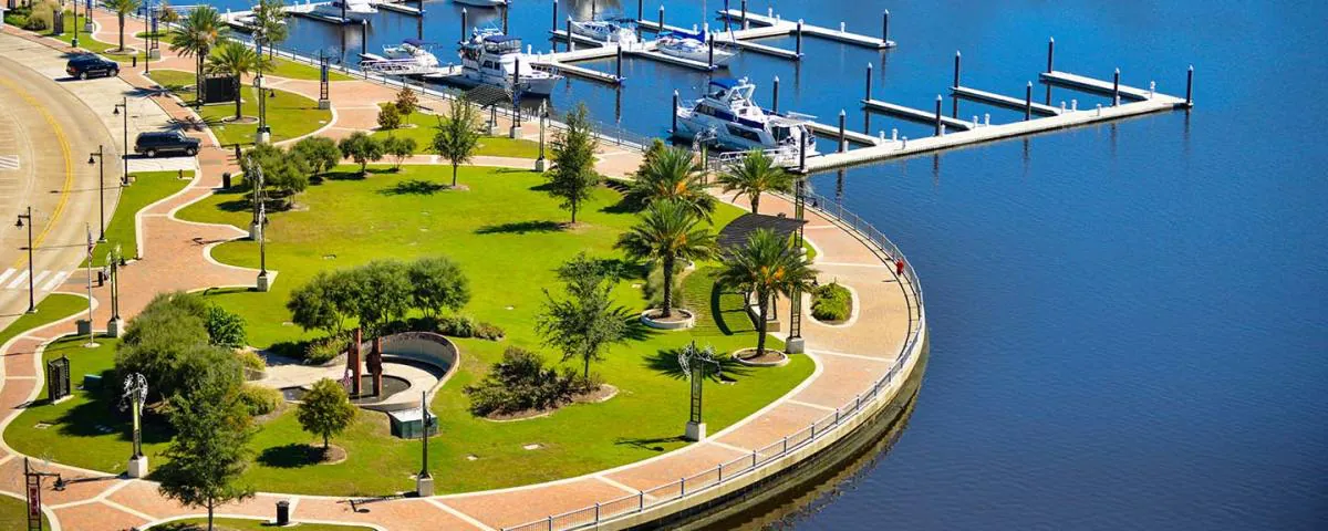
Lake Charles has been rebuilding itself out of whatever it could sell next for 130 years. The 1911 City Hall went up while the sawmills were still running. The 1912 courthouse spent the profits. The Imperial Calcasieu Museum carries the longer arc — Atakapa-Ishak presence, lumber, sulphur, oil — and the hurricanes (Rita 2005, Laura 2020) that keep editing the skyline before the residents finish moving back in. Bord du Lac, French for edge of the lake, is still where the city negotiates with the water that named it.
Louisiana's industrial origin story starts in these parishes, not in New Orleans. On September 21, 1901, drillers near Jennings brought in the state's first oil well at 7,000 barrels a day — four months after Spindletop. The 1923 Kansas City Southern depot in DeQuincy is one of three urban depots left in the state. DeRidder's 1914 jail connects to its courthouse by an underground tunnel — the accused walked to trial without crossing daylight. Whiskey Chitto runs sand-bottomed and clear by Louisiana standards. Lacassine's 35,000 acres winter the Mississippi Flyway. None of this was built for visitors.
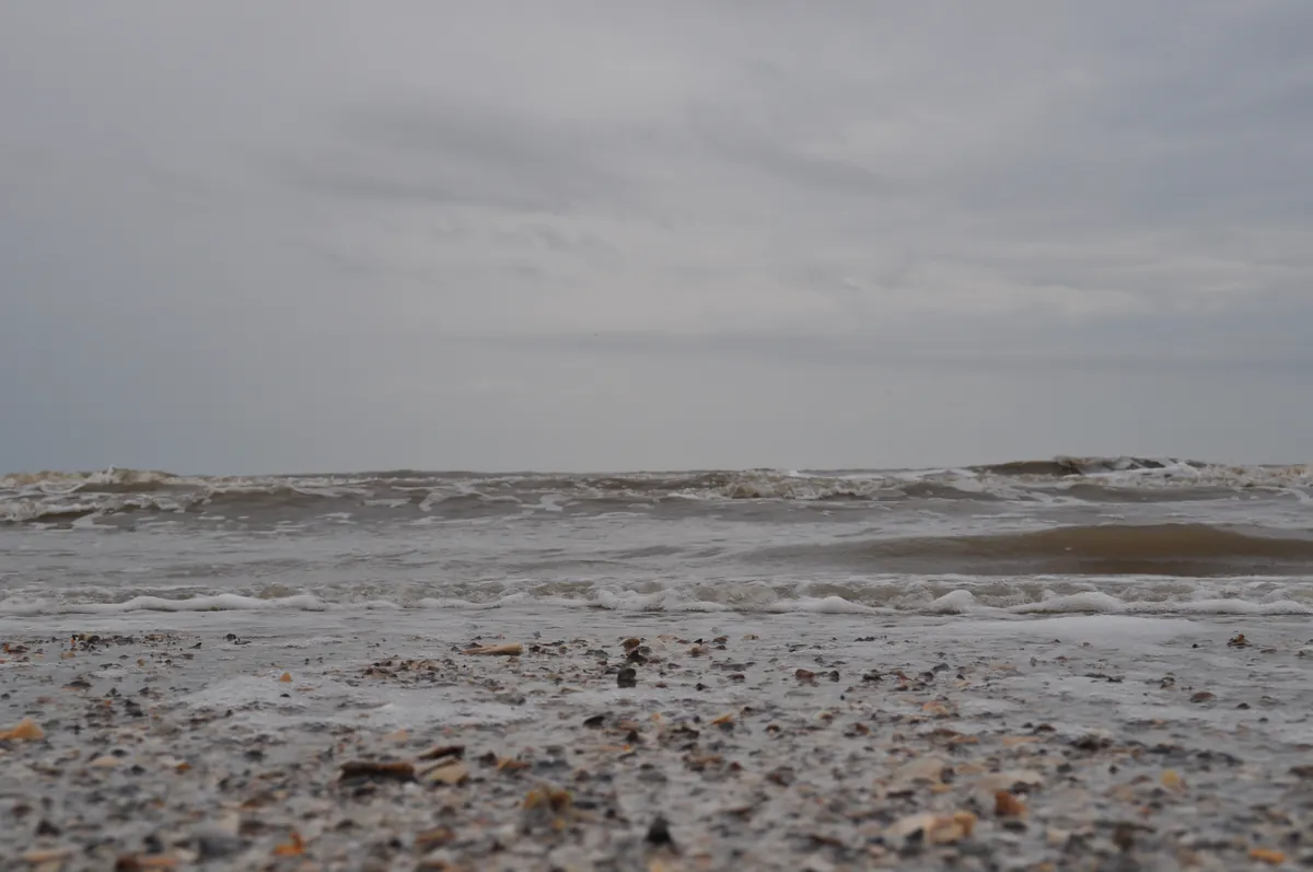
Sulphur exists because Herman Frasch broke Sicily's monopoly. In the 1890s his superheated-water process pulled molten sulphur out of the salt domes under Calcasieu Parish, and a company town followed — the Brimstone Museum holds what's left of it. Twenty miles south, Adventure Point opens the Creole Nature Trail and the landscape stops being industrial. Sabine's boardwalk runs 1.5 miles through alligator marsh. Holly Beach is undeveloped Gulf, a working coast where shrimp boats outnumber umbrellas. Industrial monopoly to 180 miles of coastal marsh (traversing the 38-mile Creole Nature Trail through Cameron Parish wetlands) in under an hour.
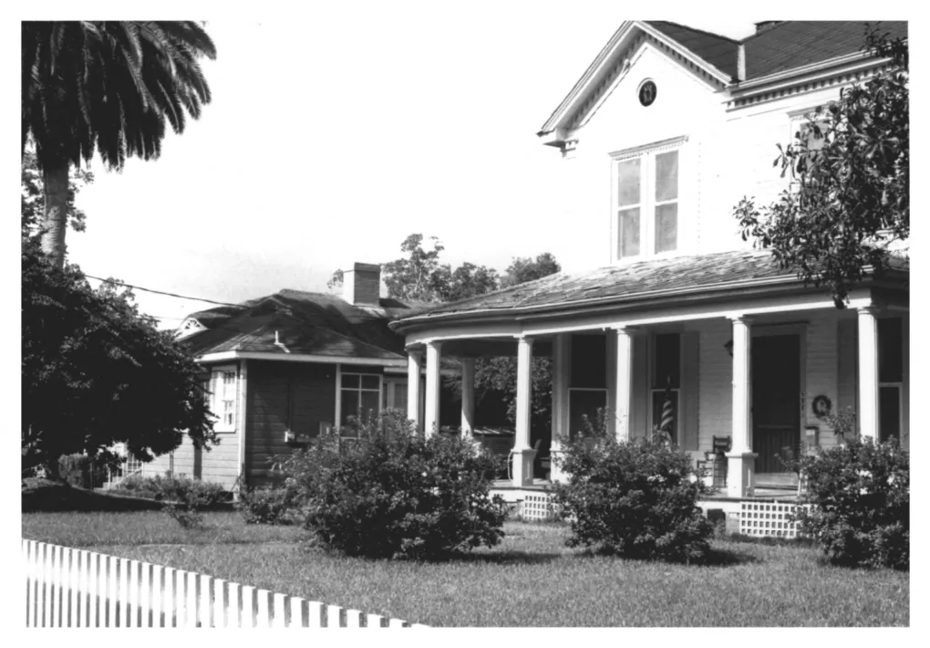
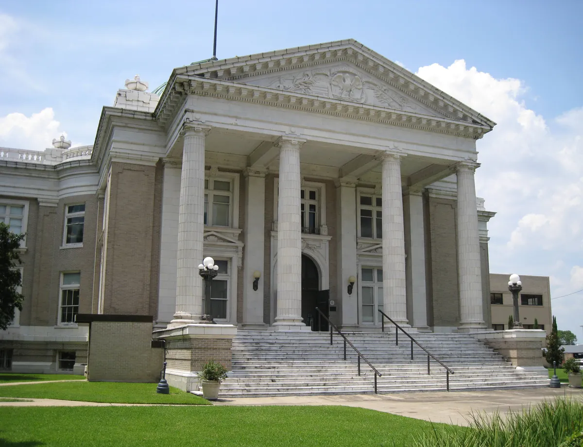
Charpentier means carpenter, and that's the joke: forty blocks of Queen Anne and Eastlake mansions designed by the same men who framed the houses, because the lumber-baron clients couldn't be bothered to hire architects. Turrets and fretwork and stained glass compete house by house. The 1900 Waters Pierce stable predates the pipelines that replaced timber. The 1929 Charleston Hotel rises nine stories on the next economy. The 1910 courthouse closes the walk: Favrot & Livaudais designed the lumber money's confidence into stone before the trees ran out.
Cameron Parish is the part of Louisiana that has never been settled, only crossed. The Atakapa-Ishak used these marshes as a highway between prairie and Gulf for thousands of years, and the 98-mile loop still moves the way they did. Sabine's 1.5-mile boardwalk puts alligators at railing height. Pintail Drive runs three miles of Cameron Prairie's freshwater marsh from the driver's seat. Peveto Woods is the first substantial stand of trees songbirds find after crossing the Gulf. Holly Beach is a working coast, not a resort. One of only 31 All-American Roads in the country — the designation is for the road, not the view.
Reading
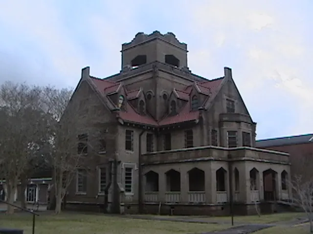
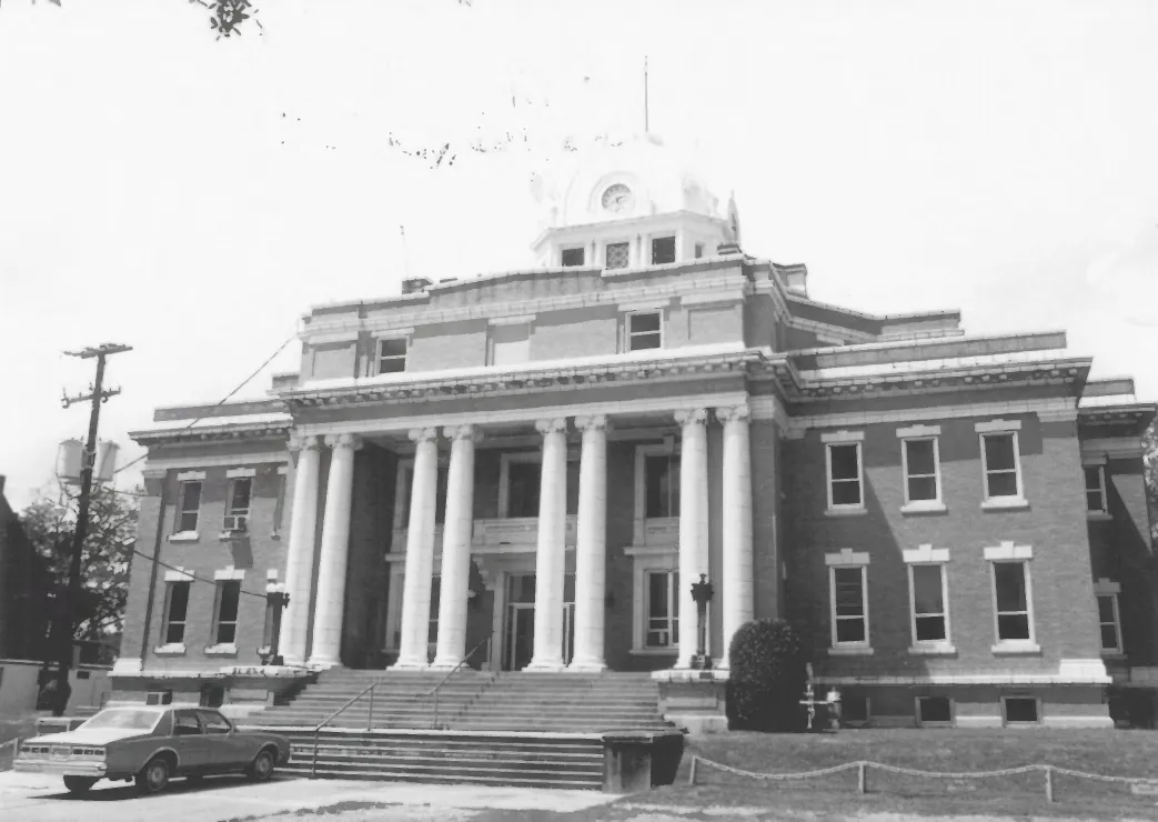
Before the parish had a proper courthouse, it had a tree. The Sallier Oak on the grounds of the Imperial Calcasieu Museum in Lake Charles has stood for over 300 years — longer than the city itself, longer than the lumber boom that built it, longer than the fires and hurricanes that periodically leveled everything around it. The museum it now anchors, opened in 1963 as the regional keeper for five parishes, holds the through-line: Atakapa-Ishak culture, the longleaf pine era, sulphur, oil. Fifty miles north in DeRidder, that same Imperial Calcasieu territory produced something stranger — a Collegiate Gothic jailhouse built in 1914, possibly the only one of its kind in the country, connected by an underground tunnel to the Beaux-Arts courthouse beside it. The jail earned its name from executions conducted off its interior spiral staircase. It's listed on the National Register. It still gives tours. Southwest Louisiana keeps what it builds.
Casinos arrived in Lake Charles in the 1990s, and what they built tells you exactly what the deal was. After petrochemical refining slowed and military homeport plans collapsed, Pinnacle Entertainment opened L'Auberge in May 2005 — a 26-story tower on the lakefront that became the tallest building in Southwest Louisiana, which is another way of saying that gaming remade this economy faster than timber or sulphur or oil ever did. The casino floor floats on the Calcasieu River, a literal translation of Louisiana's riverboat gambling law into architecture. More than 2,400 people work there. Gaming tax revenue funds civic projects across Calcasieu Parish, which means L'Auberge is not just entertainment — it is part of how the city pays for what it needs. The tallest thing on the skyline is also the thing that keeps the lights on.
The Southwest Louisiana Boudin Trail doesn't begin at a restaurant. It begins at a counter — the kind where the person taking your order is the same person who made what's in the case. B&O Kitchen & Grocery has operated that way on Burton Street in Sulphur since 1983, three generations of the same family running a place that is exactly what it says: kitchen and grocery both, boudin and cracklins alongside whatever else you came in for. Twelve miles east, Hebert's Specialty Meats on Country Club Road built its name on boudin balls — breaded, fried, eaten in the parking lot. Steamboat Bill's started in 1982 as a roadside seafood operation on Broad Street; Katherine Vidrine, who came here from Chicago, moved it to the Calcasieu lakefront, where the menu still centers on crawfish boils, gumbo, and fried platters. The Lake Charles Convention & Visitors Bureau formalized this circuit as the Southwest Louisiana Boudin Trail. The food was already there.
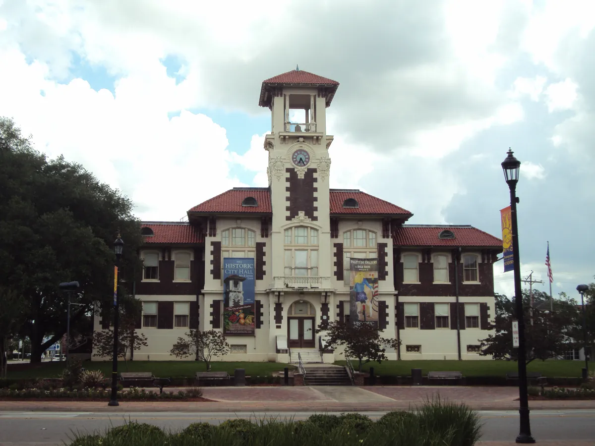
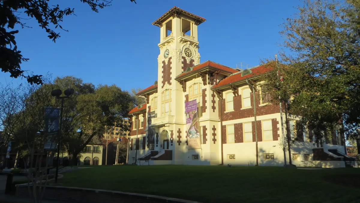
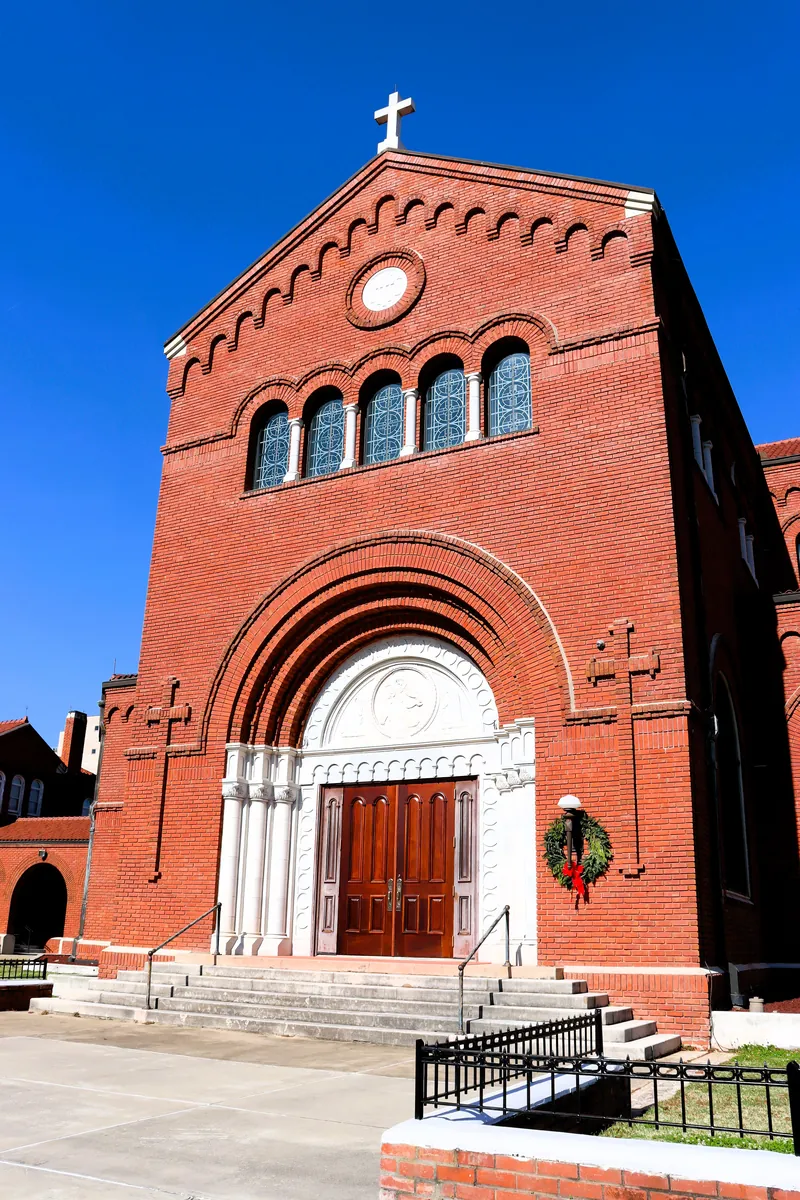
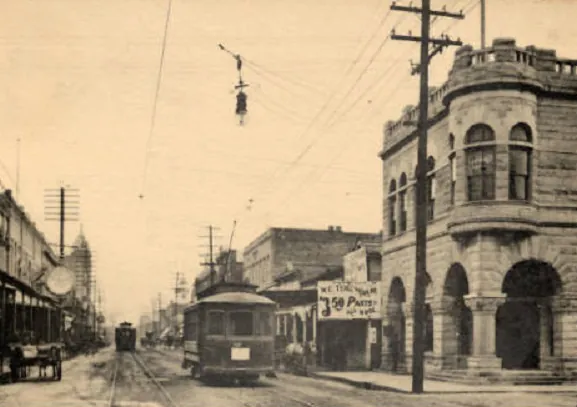
In April 1910, fire moved through Lake Charles and took the city's civic and religious infrastructure with it. What replaced it arrived fast and with ambition: a new city hall by 1911, featuring terrazzo floors, pressed-tin ceilings, and Romanesque Revival arches; a Classical Revival courthouse in 1912, designed by Favrot & Livaudais out of New Orleans; and a Gothic Revival cathedral, also completed in 1912, in the heart of the Charpentier Historic District. That cathedral became the mother church of the Diocese of Lake Charles when Pope John Paul II established the diocese in 1980. The city hall held municipal offices until 2004, then became an arts center — the Black Heritage Gallery and Gallery by the Lake now occupy what were once administrative rooms. All three buildings still stand. Lake Charles has burned, and been struck by hurricanes, and rebuilt each time. These buildings are what the rebuilding looked like.
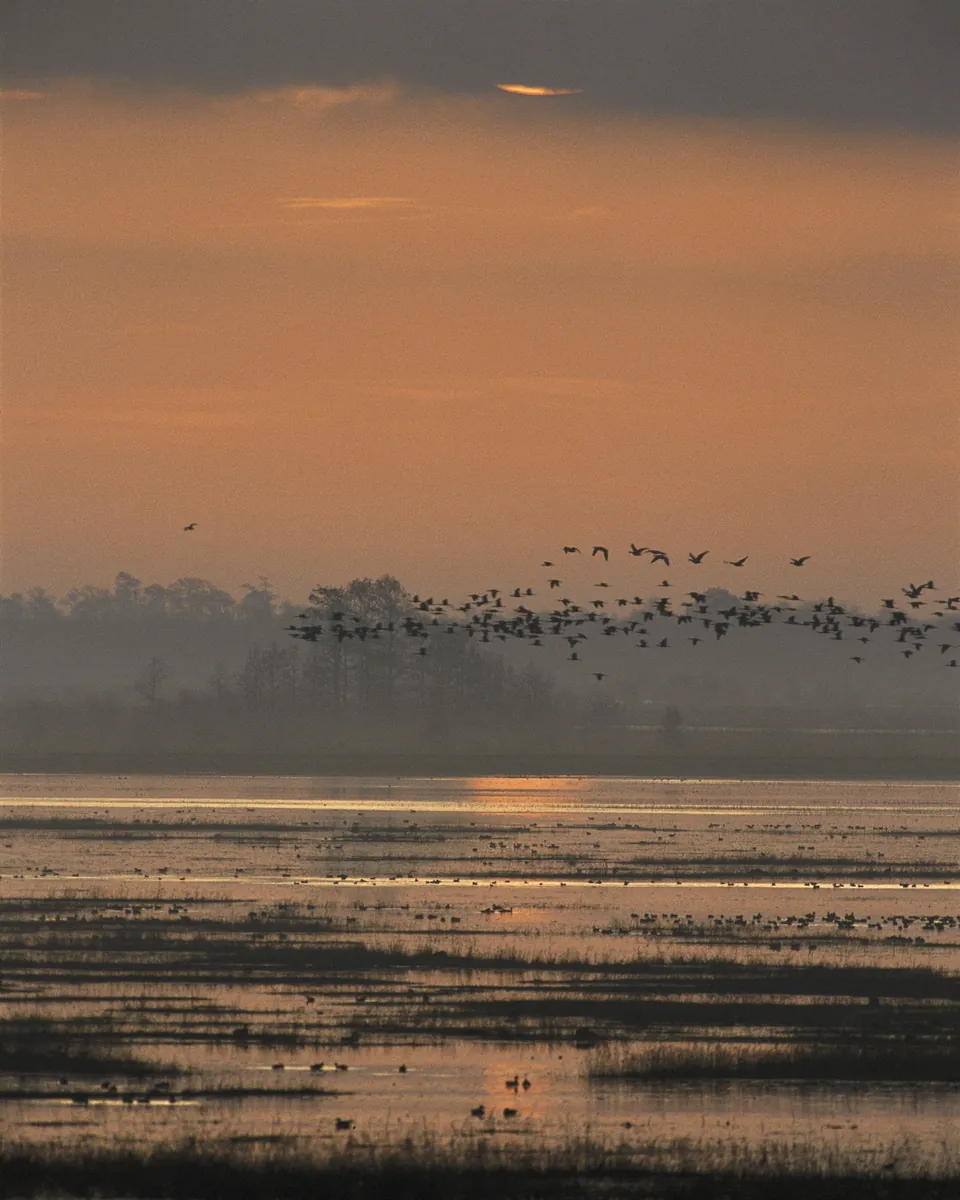
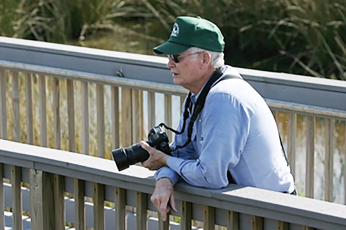
The Creole Nature Trail All-American Road loops 180 miles through Cameron and Calcasieu parishes, passing through some of the most productive wetlands in North America without a single traffic light. The route threads between three national wildlife refuges — Sabine, Cameron Prairie, and Lacassine — that together protect over 200,000 acres of marsh, prairie, and chenier habitat. During spring and fall migration, the corridor funnels millions of neotropical birds along the Gulf Coast flyway. The Sabine refuge's Wetland Walkway puts visitors at eye level with alligators, roseate spoonbills, and muskrat lodges. Pintail Wildlife Drive at Cameron Prairie offers a seven-mile auto loop through managed impoundments where wintering waterfowl gather in concentrations that can darken the horizon. The trail earned its All-American Road designation in 2002 — one of only 43 in the country — for being a destination unto itself, not merely a route between destinations. The Adventure Point visitor center in Sulphur orients the drive, but the real education happens at the roadside pulloffs where the marsh stretches to the Gulf and the only sound is wind through the spartina grass.
Between 1880 and 1920, the longleaf pine forests of Southwest Louisiana made Lake Charles one of the wealthiest small cities in the South. The lumber barons who built those fortunes had one problem: there were no architects. So the carpenters who cut the timber designed the houses themselves — improvising Queen Anne turrets, Eastlake brackets, and Colonial Revival porches from pattern books and imagination. The result is the Charpentier District, a 40-block neighborhood where no two houses look alike and none follow the rules. The French word means "carpenter," and it fits — these were buildings designed by the people who held the hammers. Over 90 of those homes still stand, their cypress frames resisting rot and termites a century later. The district earned its National Register listing not for any single masterpiece, but for the collective audacity of its builders: working men who decided that if no architect would come to Lake Charles, they'd become architects themselves.
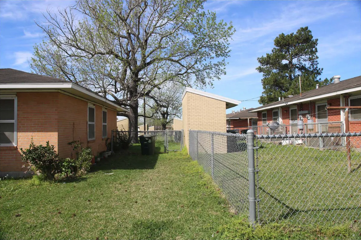
Mossville was a community of free Black families before the Civil War — one of the oldest in Louisiana, founded in the 1790s by formerly enslaved people who built farms, churches, and schools on the prairie north of Lake Charles. For nearly two centuries, Mossville persisted as a self-sustaining settlement. Then the petrochemical plants arrived. By the late twentieth century, fourteen industrial facilities ringed the community. Residents documented elevated cancer rates, respiratory illness, and contaminated water. In 2013, South African chemical giant Sasol offered buyouts to acquire land for a $21 billion ethane cracker complex. Most residents took the money. Mossville, as a place, is gone — replaced by industrial infrastructure. The story is one of the starkest examples of environmental racism in the American South. In Lake Charles proper, Carver Courts tells a different but connected chapter. Built in 1959 by the Housing Authority as 44 brick duplexes for Black families during legal segregation, the development was nominated to the National Register in 2018 under Criterion A for Social History. It is still occupied — a rare example of postwar public housing that survived the demolition waves that erased similar developments across the South. Black Lake Charles has always existed in the tension between building something permanent and watching external forces threaten to erase it. That tension has not resolved.
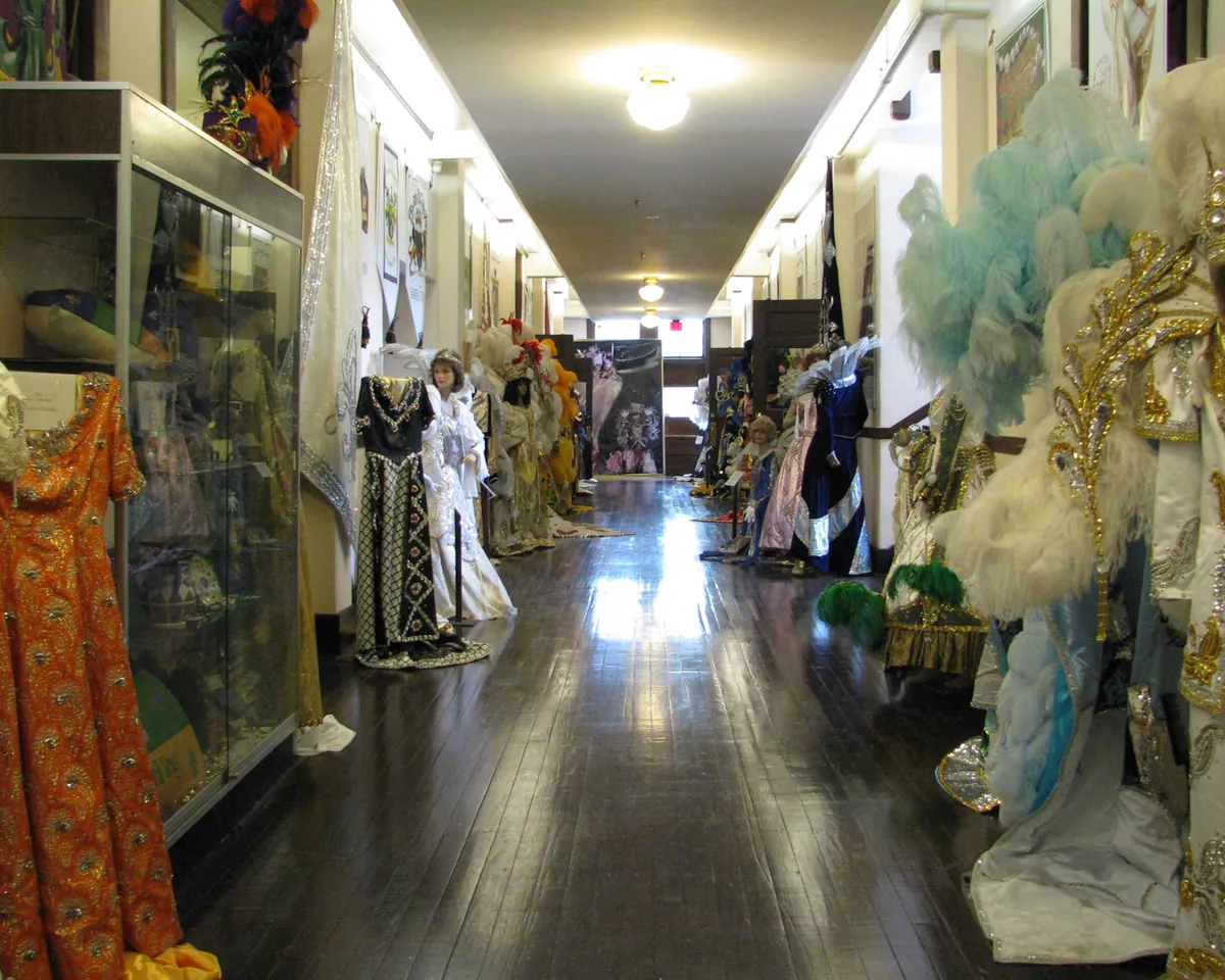
New Orleans gets the reputation, but Lake Charles runs the second-largest Mardi Gras celebration in Louisiana — and locals will tell you it's the one they prefer. The difference is proximity. In Lake Charles, the krewes are your neighbors. The Royal Gala at the Civic Center draws thousands, and the costume competitions are taken with a seriousness that borders on athletic. The city's krewe tradition dates to the 1880s, when local social clubs organized the first formal balls. By the mid-twentieth century, Lake Charles had developed its own Carnival identity: less brass band, more Cajun two-step; less Bourbon Street spectacle, more family-scaled parade where your kid catches beads thrown by her math teacher. The Iowa Chicken Run and the Krewe of Krewes parade draw visitors from across Texas and Louisiana, but the heart of it is the neighborhood krewes — organizations that fundraise year-round and measure their success not in tourism dollars but in how many floats they can field. The 1911 Historic City Hall hosts exhibits on the krewe tradition, and the lakefront becomes a staging ground where the entire city seems to show up with lawn chairs and ice chests. It is not a scaled-down New Orleans. It is a different thing entirely.
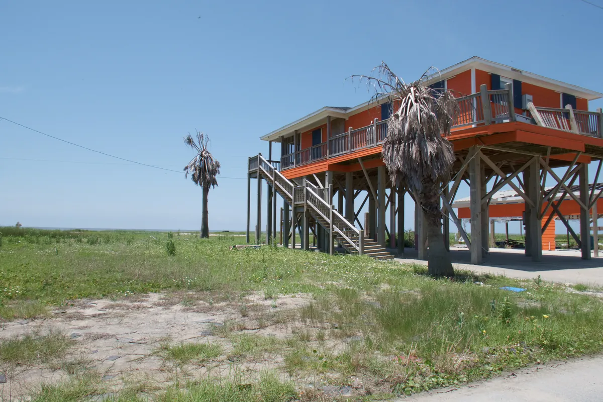
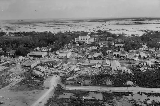
Cameron Parish is the largest parish in Louisiana by area and one of the least populated — roughly 5,000 people spread across 1,300 square miles of marsh, prairie, and coast. The math tells you everything: this is land that storms claim regularly, and the people who stay know it. Hurricane Audrey killed 526 people here in 1957, still the deadliest June hurricane in U.S. history. The parish rebuilt. Rita flattened Cameron and Creole in 2005. They rebuilt again. Then Ike in 2008, and Laura in 2020 — a Category 4 that drove a 17-foot storm surge across the entire parish and left structures that had survived every previous storm in rubble. Cameron Parish's population has dropped by more than half since 2005. Every return is a conscious choice: to rebuild the same house on the same chenier ridge, knowing the next storm is already forming somewhere in the Gulf. Holly Beach, once a continuous row of camps and fishing cabins, now stands as a scattered grid of elevated pilings — each one a bet placed on the same coordinates. The people here don't romanticize the storms. They calculate them.
Southwest Louisiana sits on top of one of the densest concentrations of petrochemical infrastructure in the United States. The story starts with the Jennings oil field in 1901 — the first commercially productive oil well in Louisiana, drilled in Jeff Davis Parish. Within a decade, refineries lined the Calcasieu River, and the region's economy pivoted from timber and rice to petroleum. Today, the Lake Charles metro hosts more than a dozen major chemical plants, two LNG export terminals, and a refining capacity that ranks among the top ten in the country. The Louisiana Oil and Gas Park in Jennings marks the origin point. But the story is not triumphalist. Every boom has a corresponding bust, and every plant brings jobs alongside air quality concerns, pipeline easements across ancestral land, and the slow erosion of coastal marshes accelerated by canal dredging. Lake Charles has ridden the petrochemical cycle for over a century — surging with each construction wave, contracting when global commodity prices drop. The tension between economic dependence and environmental cost defines daily life here more than in almost any other American city of its size. The industry is not a backdrop. It is the main character.
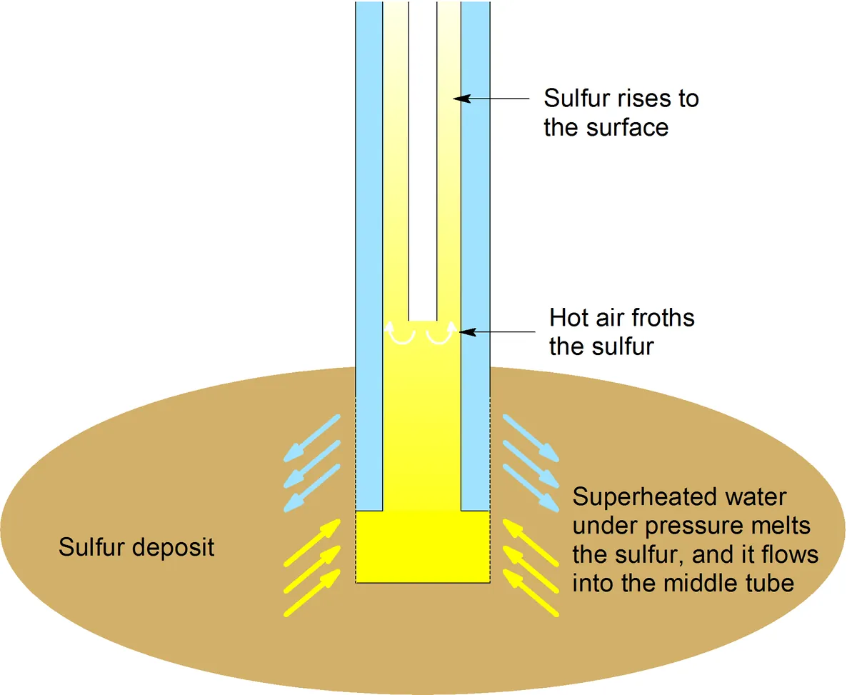
In 1867, a survey crew drilling near the Calcasieu River struck something unexpected beneath a layer of quicksand: a massive dome of nearly pure sulphur, 200 feet underground. The problem was getting it out. Conventional mining failed — the quicksand flooded every shaft. For thirty years the deposit sat untouched until Herman Frasch, a German-born chemist in Ohio, proposed an idea that sounded insane: pump superheated water underground to melt the sulphur, then force the liquid to the surface with compressed air. It worked. By 1903, the town that sprang up around the mine had named itself Sulphur, and the Frasch process had broken Sicily's centuries-old monopoly on the global sulphur market. At its peak, the Calcasieu mines produced over a million tons a year, supplying the fertilizer, gunpowder, and vulcanized rubber industries that drove early twentieth-century growth. The mines closed decades ago, but the Brimstone Museum in Sulphur preserves the story of the process that changed global chemistry from a patch of Louisiana prairie.
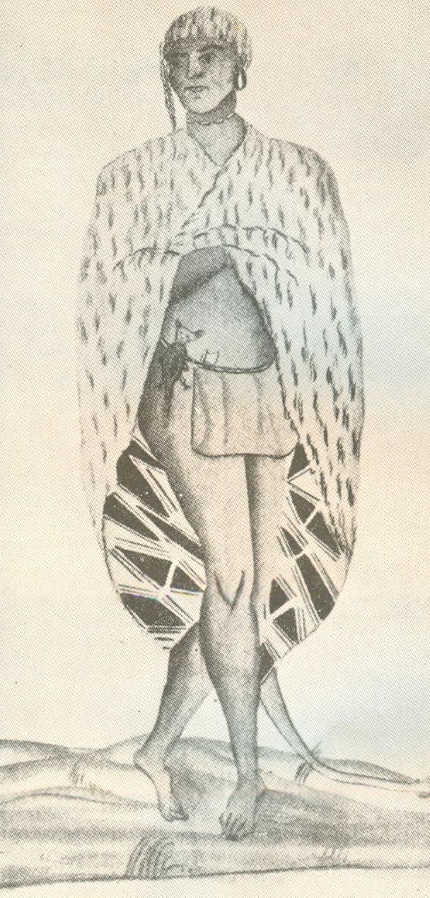
Long before the lumber barons and the sulphur miners, the coastal prairies and cheniers of Southwest Louisiana belonged to the Atakapa-Ishak, a confederation of bands whose territory stretched from Galveston Bay to Vermilion Bay. Their name — given by the Choctaw and meaning "man-eater" — was a slander that stuck, used for centuries to justify displacement. The Atakapa-Ishak called themselves Ishak, simply "the people." They were fishermen and hunters who built shell middens along the Calcasieu and Mermentau rivers, navigated the coastal marshes by pirogue, and harvested the same shellfish beds that commercial operations still work today. French and Spanish colonizers encountered them repeatedly but never established the mission system that shaped other Gulf Coast tribes. By the nineteenth century, disease, displacement, and intermarriage had scattered the surviving bands. The Atakapa-Ishak have no federal recognition and no reservation, but the nation persists — reorganized, active in cultural preservation, and still present in the same coastal landscape their ancestors shaped for thousands of years. The name Calcasieu itself likely derives from an Atakapa word meaning "crying eagle."
Lost places
Happening this month
Before you go
Hurricane Audrey, 1957. A Lake Charles girl's account of the storm that took 500 lives from Cameron. The Cajun coast before and after.
Plan your trip
The only thing left to do is go.
Plan your visit
Editorial content compiled with AI assistance. Place details verified against public records.